Cafes and Water Routes : Crawford Bay to Balfour … and onto Nelson
Despite our very best intentions of making an early start this morning, we just didn't have it in us. When we tried to stand up we quickly discovered just how stiff and sore our legs were after yesterday's descent from the Gray Creek Pass. When Red's Bakery opened at 7:00 am we headed over for some breakfast. Stepping into the warm wooden building was like discovering a small piece of heaven. Piles of freshly baked scones, danishes, muffins, cinnamon buns, squares, cookies, buns and more covered every surface. The smell was overwhelmingly delicious, and the only trouble was deciding on what to order!
We sat on the outdoor patio enjoying two baker's breakfasts (egg, cheese, tomatoes, lettuce, and mayonnaise on a warm, fresh bun) and coffee. As we happily enjoyed our breakfast a steady stream of local residents stopped by, all laughing, joking, and teasing each other as they waited to enter the tiny bakery. A bakery or café can become the heart of a community, and it certainly felt like this one played that role, with very good reason!
After breakfast we did laundry, which ended up taking longer than we anticipated. In the end we didn't head out from the campground until around 9:45 am, much too late to catch the 11:10 am ferry from Kootenay Bay to Balfour that we had been hoping to board. Sometimes things don't work out as anticipated, but luckily this time it didn't really make much of a difference.
The campground where we stayed was at the edge of Crawford Bay, so we didn't see much of the village on our way in last night. The community has about 350 residents, and according to local folklore it was named after James Crawford, a prospector and trapper that the Ktunaxa called White Man Jim. Crawford Bay is a community of artisans, and it is known for its Starbelly Jam, an annual music festival held in July which features a wide variety of musical styles. It has also hosted the Kootenay Lake Fall Fair annually since 1910, during which competitions are held for local produce, homemade goods, and artistic creations.
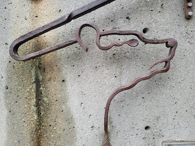
As we made our way down the main street the creative aspects of the community were clear. We passed a Nordic wood carver, a forge and metal working shop, a leather worker, a potter, a weaver, and a jeweller. There was also an artisanal broom maker, and the proprietor, who may well have been a witch, who gave us a cheery wave as we passed her workshop. I would gladly have stayed and explored all these amazing looking places as I have loved the expansive cultures of the coasts in Canada!
After leaving Crawford Bay we followed the same narrow, winding, two-lane highway that we were on yesterday. The morning rush hour following the early ferry was clearly under way, and there were no shoulders on the undulating highway, making the many blind corners a somewhat hair raising experience. It was another stretch of trail that left us wishing the Trans Canada Trail had actually been completed, and not just connected using whatever means were readily available.
It was an 8 km walk down the side of the highway, which was mostly forested, with the occasional home or small business tucked in among the trees. Mostly the view was limited by the thick coniferous forest, but as we approached the ferry terminal at Kootenay Bay we got a pretty clear view of the snowy peaks in Kokanee Glacier Provincial Park. One of them in particular has been made famous by Kokanee Beer.
Vehicles travelling on Highway 3A, and people hiking or cycling on the Trans Canada Trail in this area, must cross Kootenay Lake on a small ferry to get from Kootenay Bay on its eastern shore to Balfour on its western banks. The crossing is about 8 km and takes about 35 minutes. Various companies have operated ferries on the lake since 1890, and the service that now runs is the longest free scenic ferry in the world.
We arrived at the small ferry terminal about an hour before the next boat left, but we were delighted to find the Ladybug Coffee shop open and doing a brisk trade beside the waiting area. It was a hot, sunny morning, so we were glad to take off our packs and enjoy a second coffee and cookie at the picnic tables outside.
There was a also a restaurant (closed), a public washroom (closed for renovations), a covered walkway with interpretive panels, and quite a few picnic tables at the ferry terminal.
While we waited we checked out the information plaques, and learned that Balfour, the community we were headed for on the far side of the bay, was founded in 1889 when Charles Busk staked a 200 acre claim at the mouth of the West Arm of Kootenay Lake. However, the community was named after Lord Balfour, a British Statesman whose family also had claims in the area. By 1892 a small village had been established, including St. Michael's Church, which is now the oldest church in the Kootenays. People soon flocked to the village, working in the nearby smelter at Pilot Bay, for logging or mining companies, as farmers, or as sternwheelers who operated the ferry.
There was also additional information on the International Selkirk Loop, which turned out to be a 450 km scenic drive that circles the Selkirk Mountains, passing through Washington and Idaho on the US side of the border, and British Columbia on the Canadian side. Apparently, much of the route following rivers and lakeshore that were historically used for transportation by First Nations People, explorers, gold seekers on the Wild Horse Trail, and early settlers.
As we wandered around, we had a beautiful view of the bay, which was lined with homes and cottages. The mountains rose up around the still waters of the lake, reflected in the smooth surface. There was a golf course just down the shore, and a small white lighthouse perched high up on the forested slopes.
When the ferry came into view around the point there was already a small line up of cars, trucks, motorcycles, and RVs waiting to board. We made the crossing on the MV Osprey 2000, which can hold 80 vehicles and 250 passengers. When it had finished loading the open vehicle deck looked pretty full, but I don't think we're anywhere near 250 people on board.
I love boats, so I thoroughly enjoyed the short crossing of Kootenay Lake. We had beautiful views down the waterbody, although we were slightly dismayed to see that the far end of the valley appeared to be shrouded in thick, brown, smoke. Presumably it came from the two forest fires that are burning nearby.
As we walked around the open deck of the ferry, climbing up onto the observation decks and enjoying the view, we were approached by several people who asked where we were hiking. One was a man who had walked the Shikoku pilgrimage route in Japan, a path we have read a lot about and been seriously tempted by. He spoke of being a henro, and said he recognized us as fellow henro. Somehow it felt like a fortuitous meeting, and like lately the universe has been sending us suggestions for future hikes.
Today’s ferry ride was just the latest in motorized water crossings along the TCT including the ferry from Port aux Basques NFLD to Sydney Cape Breton, one from Dartmouth to Halifax NS, one from Riviere-du-Loup to Saint-Simeon QC, one from Quebec to Levis QC, several river ferries in Northern Saskatchewan, and today’s venture across Kootenay Lake from Kootenay Bay to Balfour.
When we reached Balfour, on the far side of Kootenay Lake, the official Trans Canada Trail turned into a water trail. Although Kootenay Lake is mostly oriented north-south, it has a 35 km long bay that extends westward from Balfour. The town of Nelson is located at the western end of the bay, and that is where the terrestrial portion of the trail picks up again.
The land route to Nelson is a continuation of Highway 3A, which looked much the same between Balfour and Nelson and as it had between Gray Creek Pass and Balfour. It was a busy, winding, paved, two-lane highway with no shoulders and a lot of blind corners that followed the contours of the bay. Small homes and a few small businesses were tucked into the trees along the road, and in some places neighbourhoods had been established between the road and the shoreline. The road undulated, at times being close to the water, and at others running along high above it, with a very steep drop-off to homes and neighbourhoods below.
About half way to Nelson we passed the entrance to Kokanee Glacier Provincial Park. This 320 km sq park was established in 1922, making it one of the oldest provincial parks in BC. It is home to two glaciers (Kokanee and Woodbury) that feed over 30 alpine lakes, and are the headwaters for many creeks. Sitting mostly above 1,800 m elevation, and featuring more than 85 km of trails, this park is used by hikers, climbers, and campers of all skill levels and abilities.
In addition to being known for stunning alpine scenery, Kokanee Glacier Provincial Park has received notoriety from several sources in its time. Prime Minister Pierre Trudeau's youngest son, Michel, was killed in an avalanche there in 1998 while skiing in the park. It was also known for Gray Peak, named after Robert Hampton "Hammy" Gray (1917 - 1945), a Canadian naval officer, pilot, and recipient of the Victoria Cross during WWII. Gray Peak is featured on the label of Kokanee Beer, which is brewed in nearby Creston.
The terrestrial portion of the Trans Canada Trail resumed at the eastern edge of Nelson, right at the base of 'BOB', the Big Orange Bridge. Opened in 1957, this iconic landmark is the only crossing of the Kootenay River in Nelson. It's central truss and three cantilevered arms are all painted bright orange, making it stand out against the incredibly steep forested hillsides that surround the town, and the dark, still waters of the West Arm.
Nelson is a community of around 11,000 people, which is tucked into a steep mountain valley at the end of the West Arm of Kootenay Lake. Deposits of gold and silver were discovered in the area in 1867, and when silver was found in nearby Toad Mountain in 1886, the town boomed, becoming incorporated the following year. Two railway lines were built to pass through Nelson, making it a transportation and distribution hub for the region. In 1888 the newly established town was named after Hugh Nelson, the Lieutenant-Governor of British Columbia.
We approached the town by walking along the waterfront on a paved cycling path through the Rotary Lakeside Park. We passed a public wharf and dock at the base of the 'Big Orange Bridge', beside which a long, sandy beach stretch out along the shore ahead. Lakeside Park is a large greenspace which features beautiful flower gardens, outdoor art exhibits, many areas for picnicking, opportunities for rowing, kayaking, SUPing, canoeing, sailing, boating, and swimming.
The paved pathway through the park is popular with local cyclists, joggers, and walkers, and it is lined with benches, trees, and secluded sitting areas, many of which feature memorials to local residents or prominent citizens of the community.
Another cool feature in Lakeside Park is Nelson's historic Street Car #23. The Nelson Electric Tramway began service in 1899 and ran until 1949. During its heyday, multiple lines were active throughout the area, transporting passengers and cargo from the mine up and down the steep hillsides of the town. Today, the Nelson Electric Tramway Society operates a single-track line along the waterfront during the summer months, taking passengers in a vintage streetcar from Rotary Heritage Park, past the mall, to the Prestige Inn. The trip takes about 20 minutes. I think perhaps this is the only section of the Trans Canada Trail that could be completed on a vintage street car. Although we walked the trail into town, we later returned and took the tram back out to the bridge just to experience the mobile heritage museum.
From the waterfront park we followed the trail into historic downtown Nelson. With over 350 heritage buildings that date back to the early 1800's, it has more carefully restored historic structures per capita than any other city in British Columbia. Many of these old brick buildings are located within a six block radius of each other, both giving the downtown a unique and charming feel, and making it easy to explore. Self-guided walking tours take visitors past the Hume Hotel, which was built in 1898, the oldest Bank of Montreal in British Columbia, which opened in 1899, the courthouse, which looks a little like a castle and was established in 1908, as well as many other historic gems.
In addition to historic walking tours, there are also 36 colourful murals located throughout downtown Nelson. Most of them have been created since 2018, with new additions being made each year by artists from around the world. They give the alleyways, dumpsters, and buildings of Nelson a colourful, artistic feel that we thoroughly enjoyed.
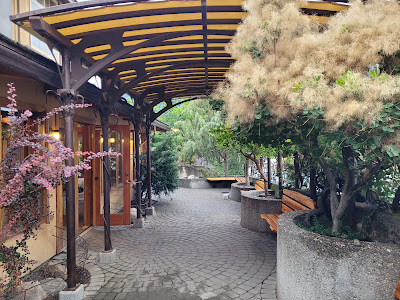
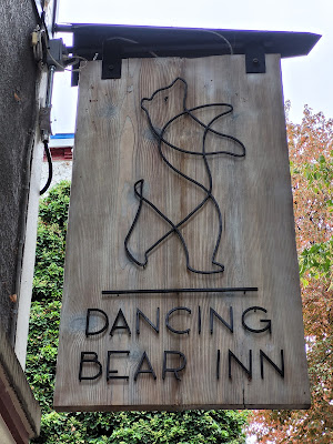
As we made our way through downtown to the Dancing Bear Inn Hostel, we really enjoyed the unique combination of heritage, outdoor recreation, culture, and art this mountain town features. The tree-lined main street was lined with one-of-a-kind restaurants, cafés, book stores, clothing shops, art galleries, art supply shops, bicycle and skateboard stores and repair shops, and outdoor outfitters. Many of the cafés and pubs advertised live music performances. The smell of baked goods was incredible!
In the end we stayed an extra day in Nelson, enjoying the culture visiting some of its amazing bakeries (favorites included the Oso Negro and the Kootenay Bakery Café Cooperative). We also replaced some gear at Valhalla Outfitters, and visited the Tourism Information Center, which is located in the restored Canadian Pacific Railway Station.
While exploring we also walked up to Gyro Park, which is a lovely urban green space that offers views out over the town of Nelson. The walk up was on a steep earth footpath through a natural forest. At the top we found a landscaped flower garden under huge tall trees, and a small wooden footbridge leading to the lookout. As with the rest of the town, there were several thought provoking art installations at the top as well.
One of the unexpected highlights of our stay occurred when we were walking down the main street. A young man of about 12 suddenly looked up and said 'Look! A bat!' Sure enough, a little brown bat was hanging from the brickwork of a shop front. It was incredibly small and cute! We had already walked passed it once without noticing, and we took the opportunity to compliment the student his keen observation skills.
There have been a few places along our 12,000 km trek that I have personally found really appealing. Among my favorites have been Charlottetown, PEI, Wakefield and Magog, QC, Saskatoon, SK, and Canmore, AB. Without a doubt, Nelson, BC has joined, if not topped, that list.
If the Pacific Ocean and the conclusion of this year’s trek to tie the Atlantic and Pacific Ocean together was not still more than 1300 km away I would simply and happily stop here in Nelson BC! The atmosphere, coffee houses, and feel of this region are incredible!
Remember to follow our entire adventure here : www.comewalkwithus.online
.jpg)
.jpg)
.jpg)
.JPG)
.JPG)
.JPG)
.JPG)
.JPG)
.JPG)
.JPG)
.JPG)
.JPG)
.JPG)
.JPG)
.JPG)
.JPG)
.JPG)
.JPG)
.JPG)
.JPG)
.JPG)
.JPG)
.JPG)
.JPG)
.jpg)
.JPG)
.JPG)
.JPG)
.JPG)
.JPG)
.JPG)
.jpg)
.JPG)
.JPG)
.JPG)
.JPG)
.JPG)
.JPG)
.JPG)
.JPG)
.JPG)
.jpg)
.JPG)
.JPG)
.jpg)
.JPG)
.jpg)
.JPG)
.JPG)
.JPG)
.JPG)
.JPG)
.jpg)
.JPG)
.jpg)
.JPG)
.JPG)
.JPG)
.JPG)
.JPG)
.JPG)
.JPG)


.jpg)
.JPG)
.JPG)
.JPG)
.JPG)
.jpg)
.jpg)


.jpg)
Comments
Post a Comment