Climate and Geography Along the Trans Canada Trail
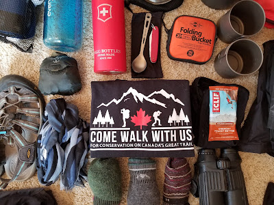
As our preparations and planning to hike the entire Trans Canada Trail we continue we have researched the weather across the nation as a means of assessing which terminus to begin at, which direction to travel, and what our daily pace needs to be. In many cases when we have previously hiked we have sought to complete a entire trail before the winter began. However, given that the Great Trail is the longest recreational multi-use trail in the world at over 24,000 km, and its entire length cannot be traversed by hiking and paddling in a single year, there are a number of challenges we need to address. Our hope is that we can set a pace that will allow us to avoid or minimize the time we spend hiking in northern Ontario or the Prairies during the winter months, or in southwestern Ontario during the hottest months of the summer. Given that we have set ourselves a 3 year time line to complete our trek from Ocean to Ocean to Ocean, we want to figure out where conditions will be most pleasant, or least dangerous, during the winter months.
The eastern terminus of the trail is located in Newfoundland, which has a rolling landscape of hills and small mountains that is dominated by exposed bedrock, tundra-like environments, boreal forest, and rushing rivers. Its winters are cold and its summers cool and potentially wet.
.JPG)
.JPG)
After our preliminary look at the trail, the weather and our proposed timeline for hiking, we decided that it would not be practical for us to paddle the waterways on the east-west portion of the trail. Instead, we plan to walk around the shorter sections, and take a Greyhound bus across the top of Lake Superior - possibly stopping at the various provincial parks along the route to hike the relevant sections. We also decided we will plan to paddle the north-south section, heading northward (with the current), likely between Jun-Aug in our third year when the rivers are ice-free. Though as with all plans, everything is subject to change en route.

The eastern terminus of the trail is located in Newfoundland, which has a rolling landscape of hills and small mountains that is dominated by exposed bedrock, tundra-like environments, boreal forest, and rushing rivers. Its winters are cold and its summers cool and potentially wet.
.JPG)
Moving west, the trail enters the Maritime Provinces, which have cooler summers, warmer winters, abundant precipitation, and more storms than anywhere else in Canada. As the trail passes through Quebec and Ontario it traverses mixed forest regions, as well as some of the most densely populated areas in the country. This region has cold winters, hot summers, and high humidity year-around in the southern reaches. Once out of Ontario, the trail passes into the Prairies, which are flat, dominated by agriculture, and can have little precipitation, very high winds, and extremely cold temperatures in winter. West of the Prairies the trail crosses the Rocky and Coast mountain ranges, where the hiker will experience huge differences in elevation, temperature, and levels of precipitation. As the pathway reaches its western terminus at the Pacific Ocean it moves into the warm, coastal rainforests of BC, with their huge trees and very high levels of precipitation. On the route north from Edmonton the trail goes through heavily forested and largely unpopulated regions before reaching the Arctic Circle, where the trees disappear. Winters in this area are long and cold, and summers short and cool.
.JPG)
After our preliminary look at the trail, the weather and our proposed timeline for hiking, we decided that it would not be practical for us to paddle the waterways on the east-west portion of the trail. Instead, we plan to walk around the shorter sections, and take a Greyhound bus across the top of Lake Superior - possibly stopping at the various provincial parks along the route to hike the relevant sections. We also decided we will plan to paddle the north-south section, heading northward (with the current), likely between Jun-Aug in our third year when the rivers are ice-free. Though as with all plans, everything is subject to change en route.
Comments
Post a Comment