Great Trail in Eastern Manitoba (Whiteshell-Winnipeg)
Having trekked more than 3500km of the Great Trail from Cape Spear Newfoundland in 2019 and now more than 2500 km of pathways across Ontario from the nation’s capital city of Ottawa through Toronto and onto Thunder Bay we had arrived to our seventh province - Manitoba!


With the fall colours settling in, we walked across the Ontario-Manitoba border on the shoulder of the Trans Canada Highway. Now in Manitoba we picked up the Great Trail at the closed Tourism Building beside the TCT Pavilion.


Glad to be back on a continuous section of path (which was off the road) we ventured westward entering Whiteshell Provincial Park on a wide well maintained gravel pathway making our way along the coastline of West Hawk Lake to the community of Falcon Lake. Having spent a relaxing evening here we rejoined the South Whiteshell Trail, a 14 km tract stretching from the trails around Falcon Lake, back to the provincial border, north to Caddy Lake.


A review of the Great Trail in the province of Manitoba makes it clear that much of the route “westward” would more charitably be seen as a meandering trail that first ventured north prior to returning south through Winnipeg toward the Canadian-U.S. border, before again heading northward toward the provincial boundary with Saskatchewan. In this manner we made our way, backtracking along our first day’s route where upon we would begin tracing along West Hawk Lake the formation of which is the result of a meteor impact crossing through Star Beach, around Penniac Bay to Howe Bay.


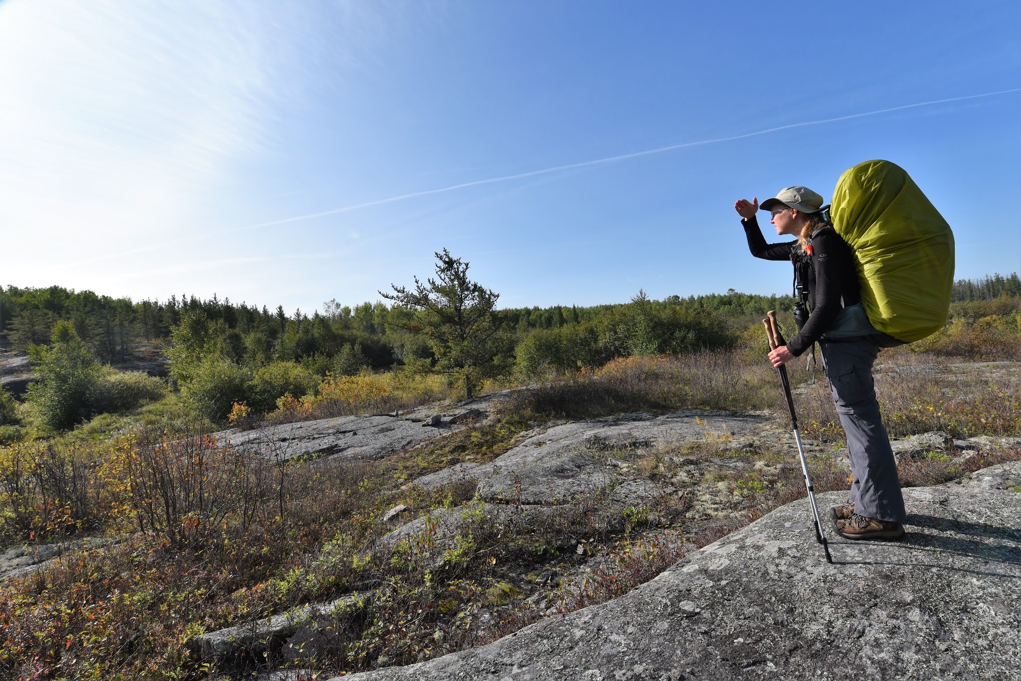
At Caddy Lake our time on the manicured gravel pathway gave way to the Centennial Trail, a 36 km wilderness tract to the community of Rennie. This section would take us into the rugged and beautiful landscape of the Boreal forest. Most of our time was spent following way-markings – which varied from Great Trail and Centennial Trail markers, to Scouting Logos, to rock cairns, to fading flagging tape – over the rocky shield. However at other times, the trail would dip into low lying stretches navigating the boggy and wet parts of the region. Much of this stretch was develop by Vern Dutton and by the Scouts and Girl Guides in celebration of Manitoba’s 100th anniversary.


At one point we were delighted to come across a beautiful red arched bridge at the juncture of a portage campsite. Its vibrant colours and unique shape was both surprising and fascinating set amid the deep greens of the forest around us. Weaving on the trail took us through dense woodlands and wet marshlands, over rocky outcroppings, and over long beaver dams. At times, and in sections following Bear Lake we found that the trail became increasingly difficult to locate and follow.


At one point the Great Trail, nearing the marshlands around Jean Lake the local pathway markers disappeared leading us to become lost whereupon we navigated our way following flagging tape onto the local roadway. Here with the aid of a local park ranger we were directed down HWY 44 to the community of Rennie about an hour away on foot. The ranger, a kind individual, offered us a ride into town, but feeling sheepish and silly for having lost the trail we took the time to feel sorry for ourselves trekking along the roadway.


After an uneventful walk into town we arrived to the Rennie Hotel where we enjoyed a meal in the restaurant and sought to warm up as well as dry out relishing the hospitality of the kind waitresses. Having taking up a table for the better part of an hour we headed back out navigating off the trail to the local campground only to find that it was closed to non-seasonal trippers.


Backtracking in the pouring rain we made our way to the Alfred Hole Goose Sanctuary back on the main roadway in Rennie. This birding site was started in Rennie in 1938 by Alfred Hole, who was a local rancher who developed the pond after being given four orphaned goslings. By 1954 it was established as a Goose Sanctuary by Ducks Unlimited and the government. At the Goose Sanctuary there is an established birding platform, museum and trappers exhibit with information on traditional hunting methods.

Given the weather there were few people around and so we backtracked along the Great Trail until we found a spot to set up our tent an shelter from the rain for the evening which thankfully also took us out of the path of the hunters ranging throughout the region.


While trekking through we received mixed comments about our experiences on the pathway from Bear Lake region to Rennie. One park ranger noted that “the trail didn’t really exist throughout parts of the park”, while several individuals bluntly informed us that “in Manitoba trails are meant to be bushwhacked and therefore have no trail signs”, while others suggested that we simply got lost. At the same time members of the provincial trail group bluntly told us that our assessments and descriptions of path conditions we were incorrect. However one individual was kind enough to write a more extensive, comprehensive, and insightful explanation for the trail challenges we faced in this section. “When the Centennial Trail was extended to Rennie under the Borders to Beaches Project completed in 2016, the Scouts and Guides advised that we did not have the resources to maintain or sign this section. It doubled the length of our original trail of 20 km. Unfortunately, nothing further had been done to this section until this year. With no one stepping up to take this on, we offered to try. As caretakers with a very limited volunteer base – basically 3 people, we began to explore this 25+ Km section. As you have discovered there are many challenges that we hope to correct over the next few years. The people who designed the trail used a method different of trail design from what we utilized and involved many areas through forest as opposed to open ridges. However, to be fair, this terrain has additional marshy areas. We completed flagging and an inventory of the entire trail this year which was a huge project – ie the flagging tape in hopes that TransCanada Trail would understand the need for additional signage.” For these reasons, it was suggested to us that for anyone deciding to thru-hike the trails of Whiteshell use apps like TrailForks and All Trails for navigation.

This commentary and the varied trail conditions across Canada also serve as a firm reminder that it is on the basis of dedicated volunteers and their tireless efforts that our regional and national trails are built and maintained. Such situations also serve to reiterate that trails neither arise from thin air nor do they maintain themselves but that they require constant upkeep and can be easily lost if not held as part of our national heritage ensuring that all individuals have the opportunity to explore the outdoors.


Trekking on we joined with the North Whiteshell Trail, a 104 km pathway from Rennie, through Whiteshell Provincial Park to Seven Sisters Falls. Leaving Rennie this section was a level ATV accessible pathway which initially meandered through the wetlands of the region prior to paralleling the main highway in sections through the park. En route the trail wove to Whiteshell Provincial Park’s most popular points including Brereton Lake, around Rice Lake, along the shores of both Cabin and Jessica Lake, to Reid Falls, over Basket Falls, to Betula Lake, around Natimik and Dorothy Lake, and through Otter Falls to the park boundary. Throughout most of this section the path was a wide and well maintained route, however there were also tracts that simply went into lakes, flooded regions, or disappeared all together. Regardless, throughout it all Whiteshell Provincial Park was beautiful in ways that go beyond words or the images we were fortunate enough to capture.


As we hiked we found that the Great Trail existed in two types of conditions : amazing or non-existent. Our experiences seemed to correlate with maps of the pathway system which we found posted throughout the park and published in 1999. These maps detailed the route of the TCT indicating three types of trails : those that were completed, trails that were in development and trails that were proposed. Our sense was that those which were completed or in development in 1999 had been refined and been maintained, where as those that were proposed 20 years ago were almost non-existent.


While at times it was challenging to find places to camp along the marshy trail or to rent lodgings owing to Covid restrictions (all campgrounds were closed) we were nonetheless met with great kindness and support throughout Whiteshell. In particular we were warmly welcomed and offered places to stay in Betula Lake at the beautiful and welcoming Betula Lake Resort and in Dorothy Lake at the magnificent Pinewood Lodge – both of which we wish that we had had time to stay at longer at!


Along the way we took the opportunity to venture off the Great Trail to visit the fascinating Bannock Point Petroforms. These are Indigenous rock formations and placings set on the shield amid the Boreal forest. Stones are used and are laid out laid out in the shape of what appear to be snakes, people, turtles, and other abstract formations.


These formations reflect Anishinaabe culture and hold deep meaning. It is suspected, though unknown, that these formations were ceremonial serving to heal, and were laid out to teach and tell stories. Unfortunately, given their public placement these formations are highly susceptible to destruction from weather, animals, and of course people.

Also spread throughout this site were red dresses, which were hung from the trees and laid across shrubs representing the stark reality that thousands of Indigenous women have gone missing or been murdered in Canada with little or no investigation as to why. These symbols of their loss are a vivid reminder not only of the legacy of how we have treated Indigenous persons but of the privilege we hold as Caucasian Canadians to be able to travel from coast to coast to coast on foot largely without fear.


As our time in Whiteshell came to an end we again lost the pathway south of Sylvia Lake. Here the trail ventured south first into a woodland and then to a washout bridge. After navigating through the water and around this section the trail signs disappeared and we followed the usual flagging tape markers into a water filled quarry were we promptly lost our way and were forced to backtrack to a nearby hydro line which returned us to the roadway. Frustrated at again losing the trail in the back-country we trekked along the road until we came to the point where the path again crossed.


We found our way back onto the Great Trail and our route wove briefly westward along an established ATV trail through marshlands filled with hunters around Natalie Lake to the impressive structure of the Seven Sisters Dam and hydroelectric generating station. In the nearby town we enjoyed a brief dinner at the wonderful Seven Sisters Restaurant before trekking across the dam to find a place to camp for the night.


The next day we paralleled our previous day’s venture following a similar raised gravel dyke along the northern shoreline of Natalie Lake backtracking eastward into the community of Pinawa.


Along the way we were excited to find a water treatment pond filled with birds and birdwatchers. Here we saw huge numbers of birds and were particularly excited to see lots of Northern Pelicans! Having spent several hours on the edge of these ponds, we moved on soon arriving into the beautiful community of Pinawa in which we would spend a few days relaxing at a local Pinawa Motel which was immaculately clean as well as scenically close to the marina and waterfront!


Cozy in this welcoming community we spent our days catching up on blogs and editing photographs of the region. We also enjoyed strolling along the beautiful shoreline trails on the forested banks of the nearby waterway.


Rested and ready to continue on we ventured northward along natural and well cared for Ironwood Trails, a wilderness path system on the shores of the Winnipeg River. Our route took us around the Pinawa Golf Club onto the Red Trail towards the iconic Pinawa Suspension Bridge, a 50m span over the Pinawa Channel.


Now tracing alongside the local roadway the Great Trail made its way to the iconic Pinawa Dam Provincial Heritage Park. Here we explored the majestic ruins and imposing structure of the historical Pinawa power plant. At this site, day trippers and visitors are free to explore the decommissioned dam on local pathways.


The Pinawa dam was originally built as the province’s first year-round hydroelectric power plant in the early 1900s on the Winnipeg River. The community of Pinewa was established as a planned Company town and soon became known as “the jewel of the wilderness”. After being shutdown in 1951 the site of the dam was used for demolition practice by the department of National Defence prior to being transformed into a Provincial Park and a popular tourist attraction.


Crossing the local road the Great Trail, joined with the Blue Water South Trail, a 40 km pathway combining natural trails, gravel routes and concessions which takes trekkers through the boreal forest and over the rocky terrain of the region. This section, formerly the bed of the Winnipeg River Railway tied the communities and power plants in the region together. Here we undertook a short concession walk to a wilderness trail which then wove through a breathtaking local forest.


10 km on, our route intersected with and followed a regional road into the community of Lac du Bonnet where we had hoped to set up at the local campground only to find that it only allowed nightly RV travellers and not campers. As such, we spent the night at Drifters Inn luxuriating with a warm shower and enjoying pizza.

The next day, after some road walking the path took us on what seemed to be a rail trail which proceeded along a series of riverside dikes which were both easy to follow and well maintained through landscape that was awe-inspiring as well as exposed and windy.


At times the Great Trail moved off of the ATV tract and shoreline crossing the road where it followed a power corridor amid a marshy landscape into the community of Great Falls. Here we our route was marked as continuing across the waterway on top of the Great Falls Generating Station, which is an imposing power plant that crosses Maple Creek.


Unfortunately, when we arrived we discovered that access to this section of the trail had been closed off and we were unable to cross the waterway. This left us not just with a Creek sized gap in the trail but also a 30 km section of pathway that was not accessible to us.


Having called around to find a solution it was made clear that we were unwelcome to camp in this area and needed to trek the extra 20 km along the side of the busy HWY 11 to the community of Powerview-Pine Falls. The result would be a very long, cold, wet and windy day of hiking more than 50 km. We eventually arrived late in the evening exhausted and drenched through. It was shear kindness of the receptionist at the Papertown Motor Inn who arranged warm soups to be made in the Restaurant and allowed their laundry machines to be available to us that kept us from breaking down. Thank you so much!


In Powerview-Pine Falls we joined back up with The Great Trail on the Red River North Trail, an almost 400 km network of regional pathways stretching south through Brokenhead Reserve, Birds Hill Provincial Park into the capital city of Winnipeg. Here we had a decision to make, as throughout this region the Great Trail was less of a direct route and more of a woven connection of pathways. We had graciously been offered help and several places to stay north of Powerview-Pine Falls in resorts and people’s cottages in communities such as Grand Marais, Grand Beach, Albert Beach, and Victoria Beach. The decision was made more challenging by the fact that each of these are amazing birding areas and had beautiful landscapes. Unfortunately it was already late in the season and we had a fixed date which we had to be in Winnipeg for. As a result we chose the most direct route southwest toward the provincial capital and in the processes lost out on visiting this magnificent region.


Instead our route from Powerview-Pine Falls followed the former Central Manitoba Railway converted, now converted into a convenient rail trail. This trail is a wide level gravel corridor tracking directly southwest across a varied landscape which w followed from Powerview to the community of Stead. After which we made our way to the coast near Beaconia, the site of a former juncture in the local rail line which now lays claims to being situated at the centre of Canada, at the exact halfway mark between the Atlantic and Pacific coasts – though not the centre point of the meandering Trans Canada Trail.


Now on the coastline of Lake Winnipeg, we navigated through the beautiful, though extraordinarily windy, Patricia Beach Provincial Park, trekking along alone wide gravel spit traversing the marshlands of the region. Trekking through this naturally amazing area we arrived into the Indigenous community of Scanterbury, also known as Brokenhead Reserve, a friendly Anishinaabe community where we resupplied and spent some time being warmly welcomed by local residents who asked us about our trek.


Southward from here the Great Trail paralleled the main highway toward Winnipeg through the communities of Libau and Selkirk. Venturing through a treed corridor, passing silos at the edge of the former railway track we eventually arrived into the community of Selkirk were the trail took a long and indirect route through thick prairie mud, strong winds, and city parks prior to bringing us into the city centre to stay in a motel. In town we found the famed roadside attraction, Chuck the Channel Cat, which was built because the region is known as “the Catfish Capital of the World” owing to record size catches taken from the nearby Red River. Check the Channel Cat is a large statue of a catfish named after the local fisherman Chuck Norquay who drowned in the river.


Heading out of Selkrik the path tacked alongside the Red River as it wove through residential areas and a wonderful Parks Canada facility – the site of Lower Fort Garry National Historic Site. Here, despite the fact that the buildings were closed owing to Covid, we were welcome to venture around the property. Lower Fort Gerry National Historical site is a restored fur-trading Hudson’s Bay post which had originally been constructed between 1830 and 1852.


The impressive Park’s Canada historical interpretive centre now on this site includes traditional HBC structures, an indigenous encampment as well as recreations of homes and a smithy for tourists to explore. Having taken up enough of the staff’s time with our questions and interest we moved on southward through the community of Little Britain to Lockport. In Lockport we crossed over the waterway on the roadway crossing on top of the impressive 270 m long St. Andrew’s Dam and Curtain Bridge at the juncture of the Red River Floodway. As we trekking over the Red River, we could see countless fishermen casting their lines spread along the shores of the waterway.


Taking the opportunity, we ventured into Heritage Park, to the water’s edge where we birded, spotting various shore species, as well as a number of herons and hawks while being treated to finding a flock of pelicans – also termed “a pod”, “ pouch”, “scoop”, or “a squadron”.


From this point onward, the Great Trail joined the well cared for path on the Duff Roblin Parkway Trail paralleling the constructed Red River Floodway. Popularly known as “Duff’s Ditch”, the Floodway is an epic engineering undertaking was constructed between 1962 and 1968 to protect the region from flooding in spring and other unexpected flood conditions. It is credited with controlling the power of the local rivers such as the Red and Assiniboine Rivers which were subject to disastrous overflow and flood conditions which regularly created expensive damage throughout the region. Given its length, and the sheer volume of water it regularly diverts, the Duff Roblin Floodway is considered the largest public-works project in Manitoba’s history. This stretch was generally an easy stroll on a wide and level trail along the tiered embankments of the floodway. Our time here however was one which foretold of the coming prairies as the surrounding landscapes was dotted with the recognizable the yellowing bales of hay that were scattered about.


About 8 km onto the trail we did something that we normally don’t do – we followed a branch of the Great Trail instead of the main route, which led us across a floating bridge over the water in the flood way into Birds Hill Provincial Park to camp for the night. Here we followed the circular trail around the park on a wide and accessible pathway. Our route took us around the park’s artificial lake and swimming area, through grasslands, and forests showcasing the natural beauty of the region. Here we spent the night relaxing and drying out while also attracting quite a bit of attention having walked in with our small tent from those visiting in large RVs complete with huge TV screens, satellites, and full amenities.


Having explored the beautiful Birds Hill Provincial Park we backtracked along the network of pathways back onto the Duff Roblin Parkway Trail. Trekking southward we entered the suburbs of Winnipeg arriving into East St. Paul, a quiet rural community which soon gave way to a dense residential region, prior to crossing the Red River along the Chief Peguis Trail.


Having crossed the Red River, the Great Trail ventured into Winnipeg only to find that there were profound differences between the city trail signage, online map, and the Great Trail app. We navigated through Kildonan Park and took the time to bird this wonderful green space, and then wove through city streets and along the banks of the water way to Point Douglas and into Winnipeg’s city centre.


Here we found ourselves lodgings, and took the opportunity to explore the Forks National Historic Site as well as a loop of the Great Trail which took us back across the waterway through beautiful urban parks past Saint Boniface Cathedral, the two story Grey Nun’s Convent, local museums and through green spaces filled with local art. Downtown we were also fortunate to be able to pass by the Canadian Museum for Human Rights and Winnipeg’s Railway Museum (both of which were closed due to Covid), and venture through Upper Fort Garry Heritage Provincial Park. We enjoyed walking on the shores of the Assiniboine River to the Manitoba Legislative Building and being able to see the iconic Golden Boy, as well as visit the monument of Louis Riel.


While we had the possibility of continuing south to the U.S.-Canadian border, with the fall weather fading and winter eminent, combined with the rising number of issues we were having with Air Canada with our pre-purchased tickets we decided that it was time to conclude our second year on The Great Trail in the beautiful city of Winnipeg. It was a central location, accessible by both transit and filled with a hospitable community making it a wonderful high note to conclude 2020 on and great place to return to in order to continue on in 2021.


Over all, we found that the natural environment, wildlife possibilities, bird sightings and wonderful trail systems made our venture through Eastern Manitoba from Falcon Beach, through Whiteshell to Powerview-Pine Falls, to Birds Hill Provincial Park and the provincial capital in Winnipeg to be amazing!
See you on the trail!
Remember to follow our entire adventure here : www.comewalkwithus.online
Comments
Post a Comment