Reflecting on the Great Trail in Eastern Ontario
Delayed by the outbreak of Covid around the world, and starting in Ontario in order to trek responsibly and respect Quebec’s provincial lockdown, we began in Ottawa, the nation’s capital, in spring of 2020.
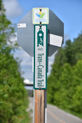
The Eastern Ontario segment of the Trans Canada Trail is home to an extensive network of hiking, biking, cross-country skiing, snowmobiling, and ATVing trails. This network offers great opportunities to do cycling or hiking loops of various lengths, visiting different communities and staying overnight in cottages, cabins, or B&Bs if desired. Between Ottawa and Peterborough the Great Trail is extremely well signed and maintained.
Setting out in May from behind Parliament and beside the Rideau Canal National Historic Site, we followed along the Capital Pathway, tracing the shoreline of the Ottawa River.
This section is located on land that is the traditional territory of the Algonquin, Anishinabek (ᐊᓂᔑᓈᐯᒃ), Haudenosaunee (St. Lawrence Iroquoians), and Huron-Wendat Peoples.
Here, on our first days back on The Great Trail, we did two of our favorite things, birding and enjoying ice cream! Strolling along the trailway took us into the sprawling suburban region around the capital where we picked up the Ottawa Carleton pathway, an abandoned railway line which we followed through Stittsville and into the community of Carleton Place.
The walk to Almonte was mostly along a pleasant gravel trail that was busy with cyclists and day hikers. It offered a nice mix of marshes, lakes, beaches, forested areas and urban parks. We enjoyed a lot of rock art in this section, as well as visiting and learning a little about the history of the communities we passed along the way.
Two days into trekking, and now beyond the downtown centre and trails of Ottawa, we quickly and unknowingly got lost on the country roads which comprise the Lanark Link. Having no power and therefore no means to navigate by Google Maps or the Great Trail App, we ultimately ended up meandering down the country roads for the better part of two days, a sight which must have brought great confusion to many of the regional drivers. While lost we walked many concessions, enjoying the rolling countryside, with its patchwork of brown and light green fields and its picturesque wooden barns. Thoroughly humbled, we eventually re-found the Great Trail in the community of Perth and followed it through the marshlands around the Beveridge Locks to the town of Smiths Falls on the Rideau Canal. Here, owing to unseasonably warm temperatures, we took a couple of days off in an air conditioned motel and used the opportunity to switch out our gear while also giving a number of online presentations via Zoom.
Relaxed and refreshed, we were back on the pathway following the Cataraqui Trail from Smith Falls to Harrowsmith. The Cataraqui Trail is 104 km long, connecting Smiths Falls in the east to Strathcona in the west. It follows the bed of a former railway which was built in the 1800's and sold off by CN rail to the Cataraqui Conservation Authority in 1998. It is a smooth gravel trail that is used by hikers and cyclists in summer and by snowmobiles and cross-country skiers in winter. It is currently managed by the Cataraqui Region Conservation Authority and the Friends of the Cataraqui Trail, who work together to maintain incredibly high trail standards. There is distance signage along the way, benches and toilets, and well-spaced communities where it would be possible to camp or stay in cottages or B&Bs in non-pandemic years.
Frequently, this section is either combined with or parallel to the famous Rideau Trail which stretches from Kingston to Ottawa and takes hikers through amazingly picturesque forests, alongside wetlands, and past historic canals. The Rideau Trail follows as closely as possible the route of the Rideau Canal from Ottawa to Kingston, passing through the communities of Richmond, Smiths Falls, Perth, and Westport. It is the longest trail in Eastern Ontario, covering 387 km of main and side trails.
During our time here we met up with Robert – a dedicated ambassador for the Cataraqui Trail system – who rode his bike out to meet us, spent time proudly showing us around the pathway, detailed the natural highlights of the region, and treated us to a wonderful dinner at his house! It seemed that the inherent kindness of Canadians and of trail angels had continued into Ontario and our second year!
Continuing on, we soon passed through the community of Chaffey’s Locks and past the region’s countless crystal clear lakes. From Harrowsmith to the upscale cottage and tourist town of Sharbot Lake we followed the K&P Trail, which was also located on the traditional territory of the Algonquin, Anishinabek (ᐊᓂᔑᓈᐯᒃ), and Huron-Wendat Peoples.
From here our route took us north to Verona, Sharbot Lake and into Renfrew county. In Verona we received an unexpected and generous donation of foods and water to resupply us by the kindhearted Anil, the owner of the local Convenience Store! Our hike on this amazing trail was filled with beautiful, shaded sections of forested trail, views of lakes, marshes, and ponds, and open farmland. The people were amazing.
Days later, in Sharbot Lake, we were again fortunate to meet, in a distanced fashion, with Kathy and her wonderful family of trail angels who were kind enough to gather two smelly and dirty hikers into their spare cottage and treat us to an evening of treats, showers, laundry and kayaking!!!
Delightfully pampered for a couple of days, we were soon back on our way westward along the Central Frontenac Trailway, passing through Kaladar. Next we followed the Hastings County Trail whose path traced along the shorelines of Stoco Lake to the town of Tweed.
From there the Great Trail wove through the region’s agricultural landscape prior to joining up with the Northumberland Rail Trail. Throughout, we enjoyed birding in the wetlands, seeing constructed Osprey platforms and turtle research sites, both of which had been built, maintained, and monitored to aid in bolstering local wildlife populations. After traversing some of the unique and indirect twists and turns in the Great Trail’s route through the communities of Spring Brook and Bonarlaw our course began to follow along the Trent-Severn Waterway.
Here, amid the blazing heat of the summer, soaked in sweat, having drunk all of our water and taking shelter under our UV umbrellas, we trekked into the beautiful town of Campbellford, where we were delighted to meet up with Jill and Darwin! This amazing couple was kind enough to let us set up our tent in their backyard, use a shower and laundry room (which had been segregated off) and to host us to a wonderful distanced dinner outside. As a result, we enjoyed an amazing evening of sharing trail tales, comparing bird lists, and talking about our respective backpacking adventures.
Given their astonishing hospitality, we were late to leave the next morning and were excited that they joined us as we walked through Ferris Provincial Park, crossing over the impressive Ranney Gorge Suspension Bridge, and as we explored downtown Campbellford! It was wonderful to share time on the trail and to have local experts join us to highlight the region they love!
Continuing on, the Northumberland Rail Trail took us through wetlands and a region filled with cottages and farmlands. In the town of Hastings, also known as the ‘Hub of the Trent’, we sat on the banks of the Trent River, enjoyed ice cream, chatted with the local police, and discovered a statue to Pieces the Fish. Here we were also warned, by kind residents, that despite the stated route of the trail it was best to cross the river on the local main street bridge, because the pathway shifted according to the seasons, which dictate the position of the local swing bridge.
Pointedly, in the summer the bridge was open to allow for the passage of boat traffic which meant that for the season the Great Trail effectively had a river sized gap in it. Thankful for the advice, we crossed the Trent River, and soon met up with Arlene and Marty to enjoy a leisurely, distanced, homemade picnic by the town gazebo in the shade! Such amazing food and great company provided a wonderful respite from the heat of the season!
In the following days we made our way into the familiar rolling landscape of the Kawarthas. Here the landscape changed again to include a vast field of drumlins. These teardrop shaped hills were left behind when the glaciers retreated some 10,000 years ago. Now their steep slopes are typically forested, whereas the flat areas in between are cleared for farmland, giving the area a distinctive, hilly, appearance. We walked a lovely rail trail through rolling countryside, forest stands, and marshes. This area seemed to support a very high abundance and diversity of turtles.
In times past, as many know, we had both spent almost a decade living in and exploring around our next destination, the picturesque city of Peterborough located on the Otonabee River! While we both had fond memories of Peterborough, the return to the region also invariably came with mixed emotions and responses. On one hand it was wonderful to return to a place that we had spent so long living in. It was indeed joyous to meet up with supportive former professors, and colleagues while leading a distanced birding trek along Jackson’s Creek with members of the Peterborough Field Naturalists (thank you Reem!).
On the other hand however, it is very true that ‘you can never go home again’. In the years since our absence much had changed in the region and at our former school - Trent University. The city now felt more like a suburb of Toronto than the tight knit alternative community we had grown up in. Perhaps highlighting this fact were the chance meetings with old friends, as well as the tough emails and ongoing hurtful online commentary we received from old roommates and romances who made it very clear that we were very much unwelcome in the area.
Nonetheless, we were happy to have had the opportunity to return and reminisce while also discovering that our old house on Hunter St. is directly on the Great Trail! Perhaps it was a foregone conclusion (even in the 1990s) that we venture along this pathway?
As such, it was with mixed emotions we headed onward along the iconic Kawartha Trans Canada Trail. On this immaculately kept pathway we crossed the awe-inspiring Doube’s Trestle bridge spanning 200m over the Buttermilk valley below, ventured past the natural beauty of Emily Provincial Park, and through the resort community of Omemee. Taking advantage of the cooler weather and shaded corridor which the pathway proceeded along, we embarked upon our first long hiking day of the season, and soon arrived into the city of Lindsay. Here we enjoyed an evening beside the Sir Sandford Fleming College campus and were honoured to be interviewed by the talented Katrina Squazzin of Global News. The resulting broadcast was seen across the nation, even by my parents in Sechelt British Columbia!
As we prepared to trek out of Lindsay toward Uxbridge and Ajax one thing however was abundantly clear - namely that the shaded rail trails, forested stretches, and agricultural landscapes that we had enjoyed throughout Eastern Ontario were quickly giving way to the development and urbanization of the Toronto region. Continuing on, even the idyllic cycling paths of the Kawarthas were being slowly replaced with city sidewalks, busy roadways, and subdivisions. Moving southward toward Lake Ontario, there was no denying that things were shifting, and with them so would our experience along the Great Trail.
See you on the trail!
Remember to follow our entire adventure here : www.comewalkwithus.online


Comments
Post a Comment