Trans Canada Trail RCGS Digital Story Map
Explore Canada : Classroom Story Map
As many of you know we have been working with the Royal Canadian Geographical Society to transform our experiences on the Trans Canada Trail
exploring the nation into a Digital Story Map for classrooms. This winter we have spent hundreds of hours
at desks designing this story map with the information and photographs
collected from hiking more than 14,000 km from the Atlantic to the Pacific on
the Great Trail.
With only a short time left to go before we set back
out onto the TCT we thought we would share some of what we have been doing,
what the goals of the story map are, and how things are going.
Virtual Exploration on the Trans Canada Trail
What would it be like to walk across the second-largest country on earth, on the longest recreational trail in the world? What would you bring with you? What would you
leave behind? What would you discover about
Canada's landscapes, cultures, and histories along the way? With the help of a Royal Canadian Geographic Independent Research Grant, the Come Walk With Us Expedition team has been hard
at work preparing a Story Map that will connect students with Canada's
wildlife, natural spaces, histories, and cultures and encourage active
community engagement through Citizen Science and volunteerism. Soon you will be invited to embark on a
virtual hike across Canada on the 28,000 km-long Trans Canada Trail (formerly
the Great Trail) to experience what it is like to traverse this vast country on
foot.
Story Mapping
the Great Trail
In November 2022, the Come Walk With Us Expedition
arrived at Point Zero in Victoria, BC. On
the 30th anniversary of the Great Trail, they had just become the
first couple to walk, photograph, blog, and bird more than 14,000 km of the trail
between St. John's, Newfoundland and Victoria, British Columbia. With 'data collection' complete between the
Atlantic and Pacific Oceans, the next step was to select stories from along the
trail that captured the unique landscapes, cultures, and histories of each
province and region.
Drawing from
750,000 photos and videos taken during the first four years on the trail, and over
800 daily blog entries, an educational and entertaining narrative began to take
shape over the winter months. Refining
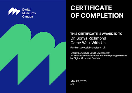
their digital storytelling skills through certification with the Digital Museums of Canada, coursework and intensive research,
the team worked on effectively combining maps, images, text, and other media
into a compelling, interactive, and educational adventure suitable for students
in elementary and high school.
Virtual Adventure
Those who choose to explore Canada through this virtual
adventure will walk the Freedom Trail in Niagara, Ontario, learning about Black
history in Canada while following in the footsteps of escaped slaves seeking
freedom on the Underground Railroad. On
the banks of the Red River in Winnipeg, Manitoba young explorers will discover
Métis culture and learn how the York boat shaped Canadian history at
Lower Fort Gary, a stronghold of the Hudson's Bay Company and the location
where the first Numbered Treaties were signed.
In Saskatoon, digital adventurers will stop at the Wanuskewin Heritage Centre to learn about Plains Cree, and they will visit the sites of epic
battles fought during the Northwest Resistance while walking the Trails of
1885. Heading west, they will discover
the creation story of the Ktunaxa People in the Rocky Mountain Trench, before
entering the temperate rainforests along the Pacific Ocean. In addition, from coast to coast to coast, virtual explorers will be able to learn about Important Bird Areas and essential Wildlife Habitats.
Call to Action
In addition to learning about the national pathway as well as the communities, cultures, histories and Important Bird Areas along the way Story Map users will be introduced to opportunities to volunteer, support and get involved in their own towns. This Story Map will not only educate but serve as a call to action for those wondering what simple steps they can take in their own communities to change the world. Whether that takes the shape of becoming involved in local projects or with local groups, volunteering in a community soup kitchen, or collecting data for Citizen Science people from across Canada will be shown how easy helping out can be. Highlights will include helpful hints, local initiatives, and projects such as Bumble Bee Watch and iNaturalist to enable anyone to get involved.
What's Next?
This spring, the Come Walk With Us Expedition will
head northwards on the Trans Canada Trail from Fort Saskatchewan, Alberta
towards Tuktoyaktuk, Northwest Territories.
When the stories from Canada's north are added next winter, the Story
Map will be ready to take virtual explorers from coast-to-coast-to-coast,
connecting Canadians to the landscapes, histories, and cultures of this vast
and beautiful country.
See you on the trail!
Remember to follow our entire adventure
here : www.comewalkwithus.online
.jpg)
.JPG)

.JPG)
.JPG)
.JPG)
.JPG)
.JPG)
.JPG)
.JPG)

Comments
Post a Comment