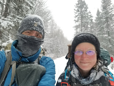
A Start, a Stumble : Adapting and Continuing on...
In 2019, having trekked from Cape Spear Newfoundland through the Maritime region into Quebec we found ourselves amid the changing seasons on the shores of the St. Lawrence Seaway. Certain that we had time left to continue on along Trans Canada Trail / Sentier Transcanadien we began to plan the next series of sections into the beautiful Charlevoix region, through the Sentier des Caps de Charlevoix and beyond to the historical Quebec City. It was here in Quebec City, an estimated 10 days further along the trail, that we would again see whether after almost 4000km of hiking we had the energy to continue on.

Instead what we found in late 2019 was that arranging to hike through the Charlevoix region and along La Traversee de Charlevoix and the Sentier des Caps de Charlevoix required one to navigate through reservation systems, pre-planned itineraries, local businesses and expectations. Neither of us is sure whether it was a linguistic divide or our poor descriptions of what we intended via email. Regardless after 4 days of attempting to gain access to these areas in 2019 we were unable to arrange permission and reservations and so concluded our hike in Riviere-du-Loup.
In 2020 (pre-Covid) and again in the spring of 2021 amid our first quarantine in Quebec City while planning a way forward we found many of the same obstacles also arose. This fall, upon returning to Quebec, we have again spent much of the last few days seeking to gain permission and navigate a means to trek through the amazing Charlevoix stretch of the Sentier Transcanadien from Saint Simeon to Baie Saint Paul. Unfortunately we have had no better luck. As it turns out, this time around we have arrived at high season for the fall colours and so almost everything is reserved or extraordinarily costly.
And while these issues may well be entirely our fault, we have the sense that perhaps it’s not just us who encounter these challenges. In talking with other hikers who have ventured across Quebec and across the province on the Trans Canada Trail it seems that most end up navigating around Charlevoix on the roadways, walking along the highway, or on the Route Verte instead of exploring this beautiful region on these particular trails.

You can’t hike that way…
The first boundary that we encountered when trying to plan our route in 2019 was the adamant insistence by staff with La Traversee de Charlevoix that this region could ‘only be ventured from West to East’ as that is what their packages and cabin systems are built to accommodate. We were also initially informed that camping with our own tent was illegal as we ‘had to rent and use only authorized facilities.’
This sense of the region is reiterated by Michael Haynes, author of "The Best of the Great Trail, Vol. 1" who notes that "unlike any other section of the entire Great Trail system, the Traversee de Charlevoix may only be walked from west to east. Further, it is a closed route, you must register to use it, pay a fee, and stay overnight in prescribed locations and accommodations. Daily use is restricted by the space available in the shelters. ... You may do the experience...for a fee."

While we will admit that the staff for La Traversee de Charlevoix eventually conceded that there were ways that we could venture through the area from East to West, it was also made clear that such a situation would have to be accommodated in between regular usage of the region during the summer and fall seasons and could not be guaranteed.
Similarly, emails and phone call inquiries led us to discover that there were fees to access the trails along the stretch of Sentier des Caps de Charlevoix, and that while camping was not permitted along the trail both cabin rentals and tenting platforms could be purchased. Thankfully the staff at Sentier des Caps are wonderful, helpful, and patient - as a result this amazing stretch of pathway is accessible to us!

What Trans Canada Trail / Sentier Transcanadien ?
Another issue we have repeatedly run into is that few in the Charlevoix region and beyond seem to have heard of the Trans Canada Trail or the The Great Trail. Indeed we have frequently been told that the region ‘has no connection to the Great Trail as the trails of Quebec are part of the Sentier National’ or been emailed 'that the Senetier Transcanadien does not come to Quebec only the Sentier National can be ventured here!'

Any assertion by us or attempt to show or explain the route of the Sentier Transcanadian has only led to further confusion with most suggesting the trail is either Sentier National or La Route Verte. Yet this entire area is firmly mapped and presumably also signed as part of the TCT route.

Though perhaps this confusion is understandable given that not a single inquiry to regional or provincial tourism has led to us receiving a hiking map or trail descriptions in the province of Quebec. Instead we have been bluntly informed by various officials on the phone and by email that ‘there are no hiking trails in the province’. Yet, oddly, questions about cycling on this route led people to happily and willingly provide information on provincial cycling pathways (which are the same trail). When we have inquired about hiking these pathways we have also been informed that ‘camping is not tolerated in Quebec’ – though I suspect that what the tourism official actually intended to mean was that camping along the trail system and wild camping are prohibited.

Camping…
On the issue of camping, though we have been firmly informed that ‘camping is not tolerated in Quebec’ we have nonetheless set out to learn where we could in fact legally camp or lodge along the Trans Canada Trail route. What we discovered is that unless we wish to go from motel to motel and have some very very long trekking days – there is a distinct lack of tenting and camping accommodation possibilities near to the TCT in Quebec.
Our concern about this situation has been heightened by facebook messages from people we know in Quebec who have warned that the trails are locally monitored and that regional people, daily cyclists and residents will actively report and remove campers along the pathways as there is a great concern about squatters, the homeless, hikers and their trash.

These sentiments were reiterated by previous Trans Canada Trail hikers who have also noted the challenges they faced while crossing the province in terms of camping and finding suitable accommodations on the route.
As such striving to be prepared we again contacted tourism websites and talked to a number of Facebook groups who almost unanimously asserted that there was no lack of accommodations along the pathways of the province since you can find Gites, Albergues, B&Bs, and motels from town to town.

When asked about this situation one inquiry to a trail builder in Quebec simply stated that 'we needed to be careful as these pathways are almost all cycling trails on which walkers and hikers are viewed as a nuisance because they disrupt cyclists on thru trips."
The conclusion seems to be then that many of the trails and routes in Quebec seem to have been built for, are intended for, and meant to accommodate cyclists and their pace – meaning that hiking across the province will prove a new challenge in all sorts of interesting ways.
It’s a Multiuse path after all
So what to do?
Well, after a lot of discussion, we have come to the conclusion, that as the Trans Canada Trail is by definition a multiuse pathway there are just some sections that are simply not meant for (or ideal for) hikers.
While of course the ferry crossings between Newfoundland and Cape Breton and Vancouver and Victoria as well as the water routes along the shorelines of Lake Superior and northward along the Athabasca, Great Slave River and Mackenzie Rivers to the Arctic are not amenable to hiking – we have come to wonder if there are other sections which are similarly just not suited to being explored on foot.

Reflecting on the trail we have reconsidered places such as the marshes in central Ontario that we waded waist deep through because we were dedicated to following the TGT signage. What of the sections that we could not navigate after encountering trails where the signs were posted through the middle of lakes? Perhaps these regions are not meant to be struggled through either but were in fact intended for snowmobile usage and for winter passage rather than as year route hiking trails?
If this is the case then perhaps the Charlevoix region is simply meant for local hikers who know when and how to reserve the pre-planned itineraries and who are able to wait for that set time to venture the trails from West to East. Equally this would mean that those trans-Canada hikers who cannot reasonably determine their day of arrival months and who are therefore unable to pre-book their time in the area, or who are travelling East to West are simply out of luck or must travel the roadways or la Route Verte instead.

Another piece left behind…
So again, what to do?
Well after 3 previous attempts at arranging to traverse this region by email in 2019, 2020, spring 2021 and having now having spent several days in Quebec City again trying to navigate a way to be allowed to trek this stretch of trail. It seems that there is no answer forthcoming.
As such, it is time to be moving on. We cannot reasonably wait for the trails to
be available in Charlevoix to continue our trek and get to where we need to get to this year.
Nor do we have an interest in adding almost 300 km of highway walking to
our 24,000 km hike by navigating around the Charlevoix region on the busy roadways as previous hikers have.

So to move on, we must simply move on. This means that rather than continuing from
Riviere du Loup or Saint-Simeon through Charlevoix, we will bypass this stretch and resume our trek about 14 km north of the community of Baie Saint Paul following through the Sentier des Caps de
Charlevoix and into Quebec City before venturing westward. We view this as a
heartbreaking shame to miss a section as famously beautiful as the Charlevoix
region, but c'est la vie. It is approximately 127 km of the TCT (and a 20 km shuttle bus ride) that we will have to come back to.
It seems that we either lack the necessary skills to convey our intention of hiking this region, are only able to be here during the wrong season, or just have regular bad luck.
Sometimes wanting to go for a simple hike isn't as easy as being able to take a simple hike.

For planning purposes the most straightforward, and helpful advice about trekking Quebec that we received came from the amazing people and resources at:
Rando Quebec (https://www.randoquebec.ca/)
Route Verte (https://www.routeverte.com/en)
We also found that the staff at Sentier des Caps to be truly wonderful! Thank you so much!


See you on the trail!
Remember to follow our entire adventure here : www.comewalkwithus.online
Comments
Post a Comment