First there is a Mountain : 24 km beyond Baie-Saint-Paul
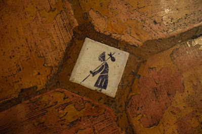
In 2016 we set to walk the Camino de Santiago along the popular and traditional 776 km Camino Frances route from Saint Jean Pied de Porte in France to Santiago Spain. We were younger, but made this decision without much foresight and therefore with little training. On our flight to Europe we heard stories from those in the aisle seats around us about the weeks and months of physical preparations they undertaken. Similarly, once we had arrived, picked up our Credential passport and checked into our first Albergue we were among pilgrims who had trekked 25 km a day for three months, and those who had spent months and in some cases a year working out to avoid any unforeseen problems on their trek.
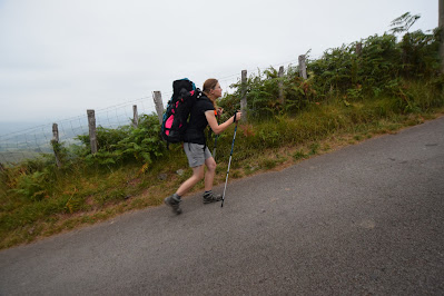
Hours later (as we did not sleep given our excitement) we were on the road out of town and up into the Pyrenees Mountains – one of the most physically vigorous parts of the Camino Frances. It took about 2 km of uphill climbing of the proposed 23 km day to Roncesvalles Spain to make the decision that perhaps stopping at the popular Orisson Albergue now only about 6 km away was the best approach.
We rationalized it by talking about “not rushing”, “taking our time”, “enjoying the moment”, but the truth was we hurt and we had both begun to have doubts. As a result, on the side of the hill, not an hour into our pilgrimage I made our first phone call in Europe to reserve two bunks for that night.
However, having set out before dawn and well before breakfast – despite the challenges, the steepness of the climb and our unpreparedness – we nonetheless arrived at Orisson just 2 hours later – at 8:30 am. Exhausted we tossed our packs down outside and had the greatest café con leche and chocolate croissant I have ever had before. Then we had another, and then …. It was 9:30 am. Unable to unpack, or take showers until 3 pm we meandered around the hillside, photographed the region, and talked to other pilgrims who had also determined to take a shorter first day.
In the process we met a beautiful woman and her younger daughter who had decided to trek to Santiago together before the one got too old and the other got too busy. Like the others around us they had trained and trained (for over a year) to prepare – but they were shaken and now were full of doubts. At the center of their concern was the fact that despite months of training they were from the Montana prairies and had never trekked with full packs up a hill let alone a mountain range. By the evening they were huddled in the corner of the warm tavern room of Orrison calling to arrange a taxi back to Saint Jean, a train back to Paris, and flights back home, while others sought to convince them that they were ok to keep going.
The next morning we, as many do, set out very early and as a result we never saw them again. In the weeks that followed we came to see that the first two days are undoubtedly among the most challenging – physically because of the Pyrenees, and mentally because excitement gives way to exhaustion amid the fullness of Albergues. It is only after a few days that all the unknowns transform into routine. We learned a fundamental truth about life and hiking because of those two ladies – namely that if you can hang on just a little longer, then you can accomplish a great deal more than you think is possible. Had they been able to get through just another day and arrive into Roncesvalles the much flatter landscapes of Spain would dominate the remainder of the pilgrimage. A month later in Santiago we both wondered a about them – did they keep going? Did they arrive to Santiago? Did they find what they needed out here – regardless of where their pilgrimage took them?
Years later, these two ladies are very
much in our thoughts. Today, despite the
fact that we have trekked more than 9300 km on the Trans Canada Trail, and in
excess of 2300 km in the last 90+ days – the reality is that pathway of that
took place in the prairies where there were no hills (at least not like this). The muscles we built up throughout the Summer
and Fall in Manitoba and Saskatchewan are entirely different than the ones we
will need here and across the length of the amazing Sentier de Caps region here
in Quebec. Today we venture up the
challenging Massif in Quebec and we feel as though it is day one again and that
we have a huge challenge ahead of us.
Today
we woke up early, and walked down the highway to the Boulangerie à Chacun Son
Pain for coffee, freshly baked croissants, and muffins for the trail.
Entering the warmth, light, and cloud of delicious smells in the busy and
bustling bakery, with its long shelves of freshly baked bread and pastries, was
as close to heaven as I think it gets down here. If only every morning on
the trail could begin with such a lovely breakfast!
Shortly after our hasty feast we headed out through town on the cool overcast
morning. Above us the hills and ridges seemed to be playing hide-and-seek
among the low clouds, appearing, disappearing, and peeking out between the
layers. We watched the show as we walked across a large playground and
green space and past a daycare filled with very happy sounding children.
The Trans Canada Trail followed the Rue Ambroise Fafard, which took us to
the edge of town, and then out through a more pastoral landscape as it skirted
the edge of the river delta and headed towards the St. Lawrence.
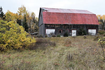
We passed B&Bs, sheep farms, and small farmhouses selling lavender, apple cider products, and artwork. At several points the road crossed small streams with delicate waterfalls bouncing and chattering down rocky, mossy beds before flowing under the wooden bridges. The homes along one side of the road were tucked in at the base of steep, forested hills that were ablaze with fall colours. Many of these homes were white stucco with red or wooden shutters like the homes that dot the countryside in France. On the other side of the road the railway tracks ran parallel to us and open fields stretched to the waterway beyond, where an enormous barge was just making its way around the headland at the entrance to the Gouffre River. As we walked along, enjoying the cool, salty smelling morning air, we could hear the sounds of a fog horn, a train whistle, and traffic in the distance.
About 5 km into our walk we came to the well-marked trail head for the Sentier de la Baie. This 11.9 km stretch of trail climbs into the mixed forests on the hills, but although it has an elevation gain of 260 m and an elevation loss of 572 m, it is very well maintained and marked, and it is listed as easy. We took a look at the map located at the trail head and then headed up the hill.
Around 10:30 am we reached a lookout at the highest point on this section of trail. We took a break to enjoy the expansive view and to savour our croissants, which still gave off a strong smell of fresh baking. We could hear the toy-horn honks of a White-breasted Nuthatch in the trees nearby, and the soft chatter of Black-capped Chickadees. A small Red Squirrel was busily collecting pine cones for its winter stash, pausing only occasionally to scold us for invading its territory. It was a very peaceful spot to be.
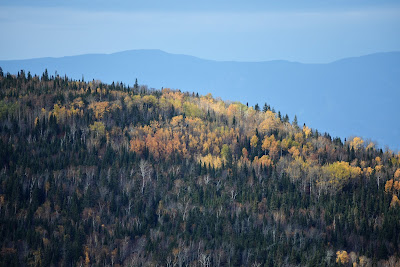
Eventually we came to another trail head, and then followed a more or less grassy track out to a paved road. The winding pavement led steeply downhill, the forest on both sides broken by small homes, cottages, and cabins perched on the banks of small streams. From this vantage point we could look straight down the road at the colourful, rolling forested landscape stretching out far below us. By this point the sun had broken through the clouds, bringing some extra warmth to the day and intensifying the brilliant fall colours.
When we reached Highway 138 we took a break at a covered picnic bench outside the Tourist Information Centre. Although the centre was temporarily closed there was a pretty constant flow of cars stopping to take a break there. The large grassy and treed property was a beautiful spot to sit, but the traffic from the highway was pretty noisy as all the trucks applied their air brakes on the steep slope beside us.
For the next few kilometres we walked along the edge of the busy highway. There was a pretty wide paved shoulder for cyclists, and at first we didn't realize there was a footpath running along beside the highway in the trees. It was still being constructed, so it was mostly still just marked with flagging tape, a few of the bridges hadn't been built yet, and there were building materials scattered along it. Nonetheless, we chose to walk it instead of the busy road, and I'd have to say that even in its unfinished state it was far from the worst section of trail we've navigated. We applaud and thank the trail builders for taking the pathway off the regional highway!
Soon we turned up another paved road that wound steeply back up to the next trail head. Many of the treed lots along the edge of it were for sale, but some already had beautiful log cabins or cottages built on them on the edges of small ponds and lakes. The dark still water in these ponds provided stunning reflections of the white birch trunks and colourful leaves on the surrounding trees. As we wound our way up the surprisingly busy road we also passed a few very large ski chalets tucked into the forested slope.
Soon we came to the trail head for the Gabrielle-Roy-Est Trail. This 6.3 km trail was also described as well marked, maintained, and suitable for beginners, despite elevation gains and losses of over 350 m. The highest point on Mont Gabrielle-Roy is around 700 m and it provides magnificent 360° views of the surrounding area, including National Parks that are more than 50 km away, like Grands-Jardins, Hautes-Gorges-de-la-Riviere-Malbaie, and Mont Grand-Fonds.
The trail was named after the renown Canadian author, Gabrielle Roy, who was born in Boniface, Manitoba in 1909. She received the Order of Canada and was made a Fellow of the Royal Society of Canada for her contributions to French Canadian literature. Among her more well-known novels are Tin Flute, Street of Riches, and Children of My Heart. She had a summer house in the nearby town of Petite-Rivière-Saint-Françoise, where she apparently wrote many of her books.
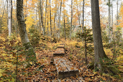
We began the climb up another beautiful forested footpath. A few hikers and a very energetic trail runner passed us on their way down the slope. It turned out to be another well-maintained trail, with small wooden bridges over the streams and wet spots, and picnic tables and benches at viewpoints along the way.
By the time we reached the first set of lookouts, our legs were starting to protest against the long climb with our heavy packs, which we weren't yet used to. We took a break at the picnic table and enjoyed the view of colourful, sun soaked rolling mountains stretching out to the horizon. Another small Red Squirrel collected pine cones nearby, and a curious Blue Jay came to investigate our snack of pocket crèpes. As we headed back to the main trail a Ruffed Grouse scurried across ahead of us.
We had thought that the lookouts were at the top of the climb, but it turned out we had another short section of rather steep climbing to do before we reached the top. Another lookout provided stunning views that seemed to go on forever as much appreciated reward.
After that we began the long descent, much of which was through a lovely, fresh smelling corridor of conifers. The trail switch backed down fairly steep slopes, zigzagging back and forth around large boulders and moss covered rock walls. In some places we could see several hundred feet straight down the slope, bringing back memories of walking the Fundy Footpath, but thankfully the trail here was wider and well-maintained, providing a sense of security we appreciated.
As we descended we could feel the elevation change in our ears. At one point we passed a large group of hikers who were posing for a photo at one of the lookouts, singing and laughing cheerfully as they snapped their pictures. The descent was a lot steeper than the climb had been, and we found ourselves navigating many sets of switchbacks as our legs began to feel more and more rubbery. As we slowly descended, the sky began to steadily darken, and when we finally reached the straight and relatively flat section of pathway at the end of the trail, it began to gently rain.
Remember to follow our entire adventure here : www.comewalkwithus.online











Comments
Post a Comment