Last
night was cool (8°C), and as we lay under the starry sky we could hear the call
and answer of groups of coyotes roaming the sides of the valley. Some of
them were quite close. We awoke this morning to the sounds of cows mooing
in the fields across the river and in the hills above us. It sounded
rather like a dawn chorus, only with cows instead of birds.
As we watched the first rays of the sun peek over the soft folds of the grassy hills, the coyotes began to bark and sing once again, welcoming the new day in the Qu'Appelle Valley. The clouds turned a bright pink, and to the west a double rainbow arched across the valley. It was an unbelievably beautiful morning!
After packing up our soaking wet tent and gear in the cool morning air we made our way down the road, stopping to admire a single black angus cow standing silhouetted against the pink and yellow sky at the very top of a hill. In the hay fields beside us we heard the distinctive calls of Western Meadowlarks before spotting several on the wooden fence posts lining the gravel road. Sitting among them was a small Prairie Falcon, which is a new species for us!
Above us two Swainson's Hawks circled, calling out before landing in a small stand of trees at the base of the hills. A little farther along we spotted a Sprague's Pipit running down the edge of the roadway!
We passed a gravel road that cut across the valley, which had been quite busy with fast moving traffic yesterday evening. Sadly, on the west side of this 'busy' interchange we found ourselves ploughing through deep gravel and sand on the road. It is amazing how much road conditions can change the nature, speed, and level of enjoyment experienced on a hike. To add to our discontentment, unlike yesterday there was no breeze at all and we found ourselves surrounded by swarms of hungry mosquitoes in the hot humid air.


Despite these minor annoyances, we couldn't help being distracted by the incredible beauty surrounding us. This part of the valley was covered in cattle ranches, with a few horse farms scattered in amongst them. The dark forms of the cows dotted the light brown hills reaching upwards beside us. Abandoned farms and homes added a touch of nostalgia to the landscape. The winding white gravel road stretching out before us, bordered by weathered wooden fence posts, gave us the sense we were in the countryside in France, or perhaps crossing the Pyrenees on the Camino Frances. However, the shapes of the sand dunes under the dry, crispy grass had a unique character all their own.


As we made our way along we found ourselves much closer to the winding Qu'Appelle River than we had been yesterday. Between its cattail bordered sides we spotted small groups of Blue-winged Teals, families of Mallards, and large flocks of Double-crested Cormorants. Along the muddy banks scurried Killdeer, and both Greater and Lesser Yellowlegs. Two Great Blue Herons took flight from a bend in the river at our approach. Perhaps most exciting of all was spotting several large groups of 50 - 100 American White Pelicans! Scattered among the fields were also several large flocks of Ring-billed Gulls. Over the course of the day we saw many groups of Pelicans flying west down the valley, perhaps in preparation for their upcoming migration.


As the morning progressed we gradually climbed. A delicate cloud of white butterflies danced on the dark purple clover that bordered the road. As we passed a large grain storage facility we noticed that many of the fence posts had bird houses attached to them. Some of these swallow boxes were very creatively decorated and painted, perhaps by a 4H Club or the students of a local school. The number of houses was truly impressive, and they not only lined the road, but adorned the fence posts that climbed right up the steep sides of the hills!
We climbed steadily on the sandy road in the rising heat of the sunny day until we could see a larger cluster of buildings on the horizon. About an hour later we came to Katepwa South, a former resort town on the shores of Katepwa Lake. We could see what looked like large homes and resorts lining the shores of the bright blue reservoir, and there was lots of traffic on the newly paved highway going into the community.
Katepwa Lake is one of the four 'fishing lakes' in the Qu'Appelle Valley. Katepwa, Mission, Echo, and Pasqua lakes once formed one long body of water, but streams flowing down the sandy valley walls brought sediments with them, which now form dams that divide the lakes into four separate water bodies. The lakes are also filled by underground aquifers that well up through springs in the valley bottom.
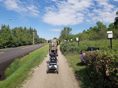


To our absolute delight, we found ourselves following a section of the Trans Canada Trail that wound along beside the highway, which followed the contours of the shoreline. The beginning of the trail was deep sand, which made for a rough start, but it soon turned into a mostly hard-packed crushed stone dust pathway. There were large pots of colourful and sweet-smelling petunias placed along the trail, metal benches, garbage cans, and even a lovely wooden gazebo with a roof, where we took a short break in the welcome shade. It was a joy to walk, and we were passed by several other cyclists and a jogger along the way.
A mix of large, modern vacation homes and smaller renovated cottages lined the trail on the lake side. On the other side rose the steep grassy slopes of the sand dunes that bordered the valley. Every so often we would pass ATV tracks leading up into the hills to lookout points high above our heads.
After following this beautiful trail for about 4 km we arrived in Katepwa Beach. This is another former resort village on the shores of the lake, and there we took a very small detour across the road into the Katepwa Point Provincial Park. This is one of Saskatchewan's smallest Provincial parks, and it was established by the federal government in 1921 as Vidal Point Dominion Park. In 1931 responsibility for the park was transferred to the province, making it one of Saskatchewan’s first six provincial parks.
The main attraction is the park's long sandy beach on the shore of Lake Katepwa. The beach is bordered by a large grassy picnic area covered with glorious shade trees. There is a large playground area and boat launch along the shore as well. The park was full of people, many of whom were swimming in the lake, while others were enjoying the shade or cooking wonderful smelling barbecues in the picnic area.
Across the road from the park was the Katepwa Hotel and a very busy ice cream store. The original Katepwa Hotel was built near Katepwa Point by European settlers in 1913. It became a destination for summer holidays, formal Sunday dinners, social gatherings, and weddings. Visitors would take the train to the nearby community of Lebret, where the hotel's horse and buggy taxi service would meet them. There was a dance hall next door, and in the 1930's, '40's, and '50's a full piece orchestra would play three nights a week. Unfortunately, in 1977 the original hotel burnt to the ground just before the summer season began.
We sat in the shade and enjoyed an ice cream before walking back through the shady park. The scoops were huge, but we were a little surprised to discover they were $6 each. The ice tea had a similarly steep price tag, reminding us we were definitely in resort country!
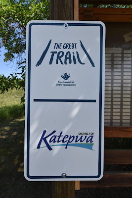
We looked for the beginning of a water trail section of the Trans Canada Trail that picks up in the park, but somehow managed to miss any signs that might have been there. We did find a bank of information plaques explaining the formation of the Qu'Appelle Valley, and describing its ecology.
We continued past Katepwa Point on the roadside path, which was paved in this section. A few golf carts passed us on their way to the Katepwa Beach Golf Course, which was busy with people enjoying the sunny afternoon. High in the grassy hills above the course a metal moose statue kept watch out over the lake.
Our path undulated along beside the road, climbing slightly up into the hills, giving us views out over the blue waters of the nutrient rich lake and bringing us a cool breeze, and then taking us back down again into deliciously shaded and magical looking corridors of trees. It was a very pleasant walk, and despite what the trail map app suggested, the trail took us all the way to the community of Sandy Beach.
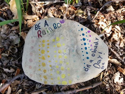
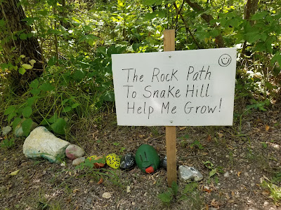
As we made our way along we enjoyed a lot of creative and colourful rock art on the edges of the trail. In the affluent resort town of Sandy Beach we walked over a small footbridge in a stand of trees, and found a 'snake' of painted rocks, and an invitation to help the colourful reptile grow. We took a short break on the well-placed bench, and enjoyed the last of the beautiful pathway. There is no denying that the trail builders of both Katepwa and Sandy Beach have done an amazing job on this section of the trail!
We knew there was a break in the 'trail' after Sandy Beach, and that it picked up again 4 - 5 km down the highway in the community of Lebret. This is one of several "problems" in the statement that the Trans Canada Trail is now "connected" coast-to-coast-to-coast, and it was a doozy.
This stretch of highway 56 was newly paved, with a thick layer of black asphalt that had been put on top of about 2 ft of existing pavement, creating a huge drop-off. The paved surface was very narrow, constantly winding, and there was absolutely no shoulder. On one side the land sloped steeply down to the lake, and on the other it sloped up the side of the valley. Vegetation grew right up to the pavement, making the winding road one giant blind corner after the next.

Of course, we walked this section of highway on Friday afternoon, when there was a constant stream of traffic heading to the lake. The patience, skill, quick reflexes, and kindness of the drivers is the only thing that kept us alive during that 5 km of death defying 'trail.' When we reached the community of Lebret, on the shores of Mission Lake we felt about ten years older and a bit like jelly. This 1 hour experience not only reminded us of the inherent hazards of either having the TCT on such busy roadways or leading to them but it also reaffirmed in our minds that we could not spend 1-2 days after Fort Qu'Appelle trekking on a highway beside the upcoming water route. We had to figure something out tonight.

With relief we turned off the highway, crossed the railway tracks, and walked into the small community. The first European to visit this area was Abbé Provencher in 1814, and in 1864 Bishop Taché chose the site for a Catholic Mission. The mission was established in 1866, making it one of the oldest in the province that would become Saskatchewan in 1905.
Lebret became the main center of Catholicism for Métis and First Nations Peoples in the area. In 1884 the federal government opened the Qu'Appelle Indian Industrial Residential School in Lebret, which was run by the Missionary Oblates of Mary Immaculate and the Grey Nuns until 1969. As with other residential schools, the emphasis was on forced assimilation, training the girls to spin, weave, bake, cook, and sew according to European traditions and methods. The boys were trained in European farm techniques, tailoring, shoemaking, printing, and painting. Efforts are currently underway at the site of the Lebret Residential School to search for the unmarked graves of children who did not survive the neglect and abuse that the students of these schools experienced.

At the edge of town we passed the Sacred Heart Catholic Cemetery, which stretched out along the waterfront. At the end of June a statue of Father Joseph Hugonard, the Roman Catholic priest who founded the Lebret Indian Industrial Residential School was removed. The peaceful protest was led by Star Andreas of the Peepeekises Cree Nation, and supported by members of the nearby Star Blanket Cree First Nation and the Federation of Sovereign Indigenous First Nations. This community is yet another place we are visiting along the Trans Canada Trail where we are watching as history unfolds.

Next we passed the large and impressive looking field-stone Sacred Heart Church that was built in 1925. We also passed the post office and the Lebret Museum, which features religious and antique articles and household items from early settlers and Métis families, including Louis Riel's sugar bowl. It also includes an Art Gallery featuring First Nation's art, that we would have loved to see, but unfortunately we visited too late in the afternoon and the museum was already closed.
We stopped at the Lebret Grocery for a cold ice tea, and to ask where the Trans Canada Trail picked up again. The very helpful owner directed us across town, and a customer commented that the residents of Lebret have been trying to get the trail joined to Sandy Beach because it is a way for the two communities to stay connected. She added that the road section is incredibly dangerous, especially for their children who ride it on bicycles to visit the beach. We couldn't agree more.
As we made our way out of town we passed a small chapel shrine high up on the hill, overlooking Mission Lake. The Stations of the Cross wound up the steep grassy hill to the small white building with its red roof which was erected in 1929. Just below it the outline of a bison had been created in white rocks on the hillside. If it hadn't been so late on a hot afternoon we would have made the pilgrimage up to the shrine to enjoy the view out over the lake.


The trail from Lebret to Fort Qu'Appelle was an undulating grassy track that ran beside the highway. It alternated between being open and grassy or shaded by shrubs and trees. While we found it challenging on this hot day to venture along we were very much grateful that it existed well off the roadway as the holiday traffic has certainly picked up in both numbers and velocity! On the far side of the highway was Mission Lake, where we caught glimpses of American White Pelicans and Ring-billed Gulls circling above and landing on the water. Occasionally we would spot groups of ducks paddling about, but they were too far off to see well. On our other side the steep grassy sides of the valley rose above us. We plodded along as the sun began to sink towards the horizon, scorching hot and making our shadows grow along.
When we got to Fort Qu'Appelle the approach took us along one very busy highway, under another, then what felt like a long way out, and then back to the other side of the original busy highway. Tired as we were, it didn't feel like an inspiring entrance to a community, but there was a Subway restaurant at the edge of one highway which we gratefully stopped at for a sandwich and cold ice tea before stumbling on to the downtown.
Fort Qu'Appelle is located on a land bridge between Mission Lake and Echo Lake. It was established in 1852 as a Hudson's Bay Company trading post, which operated until 1854. The post was revived again in 1864, and was active until 1911, with most of its activities being related to the fur trade. It also shipped pemmican down the valley to supply fur traders who were active farther north. The original post has been preserved as a historical site and museum, which we passed on our walk through downtown.

The name 'Qu'Appelle' comes from the French word for 'who calls' and is derived from the Cree name 'kah-tep-was' meaning 'river that calls.' It is based on the legend that was recounted by Mohawk and Canadian author E. Pauline Johnson. The story says that a young First Nation's man was on his way home from a hunting trip, anxious to reunite with his fiancé, when he heard a voice softly calling his name. He answered 'Qu'Appelle?' meaning 'Who is calling?' He received no answer except his own echo, and upon returning home discovered that his betrothed had died suddenly, calling his name with her last breath. The valley where he heard the voice calling was named the 'Qu'Appelle Valley.'


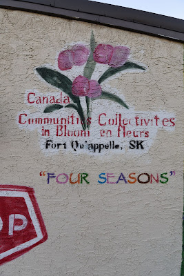


We walked the Main Street of Fort Qu'Appelle, enjoying an array of colourful murals on the sides of the buildings, which featured a mix of First Nations, Métis, and settler themes and histories. There were also several pocket parks, and as we explored the town we admired the elaborately carved tree stumps that were displayed along the quiet treed streets. Many of the stores had already closed for the evening, but there were still quite a few people out enjoying the warm summer evening. It was a pleasant end to a long and challenging day.
See you on the trail!
Remember to follow our entire adventure here : www.comewalkwithus.online








Comments
Post a Comment