The Great Trail in the Greater Toronto Region (Lindsay to Orillia)
Having ventured more than 500 km from Ottawa, the nation’s capital city, to Durham region along The Great Trail we were set to enter into Canada’s largest city and urban centre – the Greater Toronto Area. To cross this section of the Trans Canada Trail from Uxbridge through Toronto, Hamilton, Brantford, Cambridge-Kitchener-Waterloo, north to Barrie, through Midland and to Orillia would comprise almost 700 km of trekking – the majority of which would be on city sidewalks and pathways as well as through urban green spaces.

After almost a month in Eastern Ontario and shortly after leaving the city of Lindsay we passed into Durham county, tracing the local river ways and weaving through the agricultural landscapes into Uxbridge. As we headed toward Uxbridge and Ajax we walked through open, expansive, agricultural areas that became increasingly hilly. We knew there were ski resorts in the area, but somehow failed to anticipate the size and frequency of the hills.

Quite a few quarries dotted the landscape in this area as well. We enjoyed the panoramic views from the upland sections, perhaps a little more because we had to work for them.


Soon after the rolling hills, forests, and shaded pathways
gave way to the seemingly endless concessions of condominiums, subdivisions,
and busy roadways of suburbia. There was little denying that since leaving
Peterborough, the cities had gotten closer, the traffic faster, and our way now
crossed more roadways and highways. Now
firmly into the city much of the Great Trail was on sidewalks and urban
pathways rather than on rail trails or wilderness routes that we have loved in
the past month. Things had changed, the
environment was again different, and with them so would our experience.


When we reached Taunton Rd on the northern edge of Ajax it was like entering a different world. A sea of houses stretched out before us, and we found ourselves walking the edge of wide, shade-less, and extremely busy roads. A long and hard day of trekking later we arrived at the first of a series of hotels that we would spend our time staying in as we ventured across the shorelines of Lake Ontario from Ajax to Hamilton. While staying in rented accommodation was costly, the truth was that we had debated what to do once into the Toronto region. We would need to recharge our devices, and hopefully get cleaned up some, and there are a few campgrounds and national parks with camping facilities in them in the GTA. In addition, the challenges of camping in a megacity were amplified by Covid 19 and the result was that we had few options available to us. In venturing along the shorelines of Lake Ontario we would hike 228 km in 7 days amid an average temperature of 38 degrees – during which time we were unable to stop into cafés or coffee shops to get snacks, cold drinks or simply get out of the heat. Ultimately, nights in air conditioned hotels soon became our expensive salvation rather than a luxury.


From Ajax onward we would venture to Pickering along a paved pathway around Frenchman’s Bay and the local nuclear power plant past the electronic surveillance “deer”, to the local marina and through an affluent neighbourhood. When we arrived at Rouge National Park our route pulled away from Lake Ontario following the Colonel Danforth Path, a shaded green valley to the community of Morningside.


Here we joined with the Pan-Am Pathway, which was a level paved trail through a long exposed hydro corridor into East York. As we proceeded through a blinding hot day, we were repeatedly engaged by curious day walkers and residents about what we were doing.


It was wonderful to be so excitedly met, and while all were very friendly – offering treats and cold water - sadly many did not know about the Trans Canada Trail, that it came through Toronto or that their neighbourhood was so closely tied to the rest of the nation. We left many fascinated individuals and youth in our wake busily checking their phones looking up the Great Trail map.


From here the pathway then followed the Don Valley River along the local – and very busy – paved cycling trail back toward Lake Ontario and into Toronto’s downtown core, where we enjoyed a couple of hours exploring the historic Distillery District, relaxing in the shade and partaking of a cool drink at the local Balzac’s Café.


During our time in Toronto itself we trekked past the Island Ferry Terminal and passed through the historical Fort York. We were also fortunate to be able to bird areas such as High Park, Humber Bay and Colonel Samuel Smith Park. Here we met up with several amazing local birders and members of the Toronto chapter of the Feminist Birder Club with whom we had participated in a public birding activity earlier in the year. An event which I was proud to take part in, and whose goals I support, but which led to an unfortunately nasty backlash against me in the professional birding community here in Canada. The results of which have made it clear that any career I have following this #hike4birds across Canada will, sadly, not be in the field of Ornithology. Needless to say, our time wandering and exploring the birding highlights of the region with Kelly and Wayne was a truly wonderful experience. Their passion for knowing the area and loving all species – even common birds – was inspiring! I always love to meet with people who despite years in the field and having epic life lists are still nonetheless excited by the simple beauty and sound of birds!


This multi day section of the Great Trail continued westward across the GTA and had us weaving between local parks, city suburbs, and along concrete sidewalks. Having followed the coast of Lake Ontario we arrived in Hamilton through parts of the glorious green spaces of the Royal Botanical Garden – which we have been members of for years. While here we took the opportunity to divert from The Great Trail to explore the RBG properties and local trails at RBG Hendrie Valley Sanctuary, RBG Cootes Paradise Sanctuary and Point Pleasant – each of which are great local trail systems and excellent areas filled with lots of wonderful birding opportunities.


Crossing the McQuesten High Level Bridge, which provided us amazing views over the local harbour a region long polluted and associated with heavy industry. However in recent years, some amazing work has been undertaken and the area is now revitalized giving local walkers, joggers and cyclists wonderful routes to explore and traverse the region!

An interesting fact is that Hamilton stands as a unique juncture in the Great Trail framework, essentially serving as a crossroads connecting the main East-West axis of the TGT with both the Niagara and Southwestern Ontario spurs of the national pathway system. Given this intersection of trails in the city of Hamilton we took the opportunity to venture throughout the city on almost 30 km of urban exploration.


Enjoying the chance to relax we trekked eastward along the shoreline segment of the Great Trail to Williams Coffee Shop and the HMCS Haida, a huge Tribal Class naval vessel that served in the Second World War, Korean War, and through the Cold War and which is considered one of the Royal Canadian Navy’s most famous ships. Hamilton is a historically laden city including recognition of its Aboriginal histories, historical sites dedicated to the War of 1812, a fascinating Steam and Technology Museum, and a number of accessible epic waterfalls! Our round about trip through the city was without a doubt an amazing experience.


Having explored the trails of downtown Hamilton we returned to our main route bringing us back to Dundurn Historical Site. Dundurn is an Italiante style vilia built in the 1830s on the Burlington heights. It served as the home to Sir Allan Napier MacNab, the railway industrialist, and Premier of the United Canadas (1854-1856).


Fascinating to anyone who enjoys local history and shoes such as Downtown Abbey, Dundurn allows visitors to see how the servants of an estate interacted with their employers as well as being able to gain a sense of how life was lived in the mid Victorian period. Though closed, we were nonetheless fortunate to be able to wander around the property and admire the architecture of the buildings onsite.

Venturing on our route wove us through local neighbourhoods, past the he imposingly beautiful Cathedral Basilica of Christ the King, over the busy HWY 403, one of Ontario’s main transportation arteries and past McMaster University’s main campus where we joined up with the Hamilton to Brantford Rail Trail.

The Hamilton to Brantford Rail Trail is a portion of the abandoned Toronto, Hamilton and is one of the regions first entirely off-road pathways for cyclists and hikers alike. This section of trail is a wonderfully graded path of crushed gravel under a welcome canopy of dense trees which kept us gloriously shaded from the blazing sun.

As we set out from Hamilton we met up with the kind and talented Rob Porter, a local avid birder and host of one of Canada’s premier birding podcasts – Songbirding ! As a distanced group we spent much of the day birding, photographing, chatting, and recording an episode his podcast series!

All and all it was a very exciting time. While venturing from Hamilton to Brantford along the local rail trail we briefly met up with Brock's Route (War of 181) and rejoined the Bruce Trail in Dundas Valley. In years past we have been privileged to have trekked along the length of the Bruce Trail (some sections more than once) as well as being trail stewards for the Iroquois Section of the pathway!


En route we were also privileged to be able to meet up and trek with a lady who had been following our adventures. She was kind enough to come out, meet us on the trail, trek for a couple of kilometers and bring us the amazing treat of cold Watermelon! A truly wonderful experience.

Our arrival into Brantford brought us to the ‘Head of the Trails’ – which was a stunning moment, not just for the memories that it brought back from hikes past, but for the simple fact that a mere 50 km to the south was the city of Simcoe Ontario – our home for the better part of the last decade before setting out to trek across Canada! Unfortunately, Covid had led to the cancellation of planned community talks and school presentations in Norfolk and so we chose not to venture in that direction.


Instead, having followed the Great Lakes into Hamilton and onward into Brantford our indirect route across Ontario turned north - a stretch that we would last almost 800 km (the distance of the Camino de Santiago across Spain) to North Bay, where we would again continue west.
Haven taken a few days in Brantford to catch up on photo editing, blog updates, and to give presentations to several local naturalists groups via Zoom we were back on the trail continuing northward battling through the rising heat and humidity of the summer.


Given the temperatures we were off early, through the shaded corridors of the SC Johnson Trail, a flat gravel pathway, which traverses a region filled with farms, and grasslands. On the edge of the beautiful town of Paris we were shocked when an lady called out my name as we made our way along the pathway. She beckoned us over and forced a very kind donation into my hand, refilling our bottles with ice cold water and with a hug wished us the best of luck. This is the random kindness that we never fail to be surprised and touched by as we trek across Canada.


We soon arrived into the town of Paris, considered one of Ontario’s if not Canada’s prettiest towns. Paris is situated where two waterways, the Grand and Nith Rivers converge and is named from the gypsum deposits found along the banks of the river and which is used to make plaster of Paris – the material which casts are made from. Paris is most recognizable for its beautiful main street, nearby waterfalls and iconic train trestle.

In town we enjoyed an ice cream in the shade from the local chocolatier prior to meeting up with an avid follower and an energetic soul Kyla - who worked at the adventure kayaking outfitters, Grand Experiences. After enjoying the opportunity to catch up with Kyla, a future Trent University student, we said our goodbyes and continued on across the river northward toward our next destination.

Now venturing along the Paris to Cambridge Rail Trail our way followed the bed of the former Lake Erie to Northern Railway – one of the last electric lines in Ontario and one of the first to be transformed into a walkway. This wide, gravel path is well shaded taking users along the banks of the Grand River. About half way along this section we stopped for the night in the community of Glen Morris.


Here we were hosted by the kind spirited Ellen and her husband on their beautifully naturalized and bird friendly eco-property! We spent an evening sharing birding stories, talking about the smart construction of houses and relaxing with ice cold drinks in hand! A wonderful evening for which we still cannot express our thanks enough.


Continuing along the Grand, snaking alongside the contours of the landscape and river bank, The Great Trail made its way to the city of Cambridge. Here our shaded rail trail concluded as we joined the Living Levee and Walter Bean Grand River Trails which would take us along paved sidewalks through the historical centre of the city showcasing local architecture, the talent of artists in the sculpture garden, and the community hub at the factory marketplace.

Having crossed the waterway our route continued on weaving us through the regional urban development, through downtown cores, university campuses, residential subdivisions, and over the various busy highways that bisect Southwestern Ontario. Unfortunately our extended venture through the cities of Cambridge and Kitchen in 40+ degree temperatures soon took their toll. As a result, the extremes of the regional temperatures forced us to take a few days off the trail, shelter in a local hotel with an air conditioner and to seek emergency aid at the hospital. In this manner we spent three days in downtown Kitchener while one of us was in bed sick in a hotel and the other remained in the regional hospital.


Feeling better for the time
off, some extra food, and slightly lower temperatures we continued through the
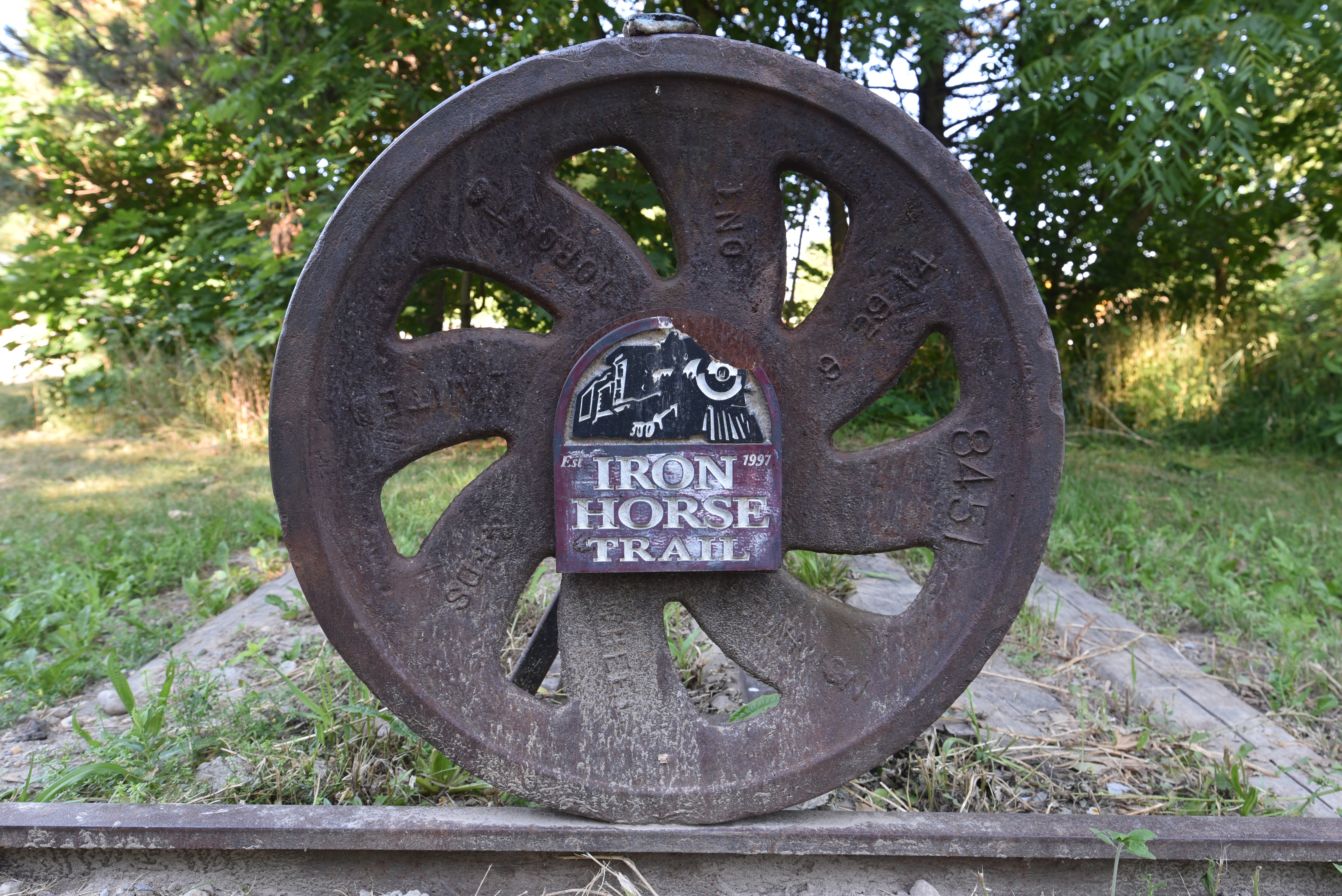
city of Waterloo along the likes of the Iron Horse and Laurel Trails which
would take us through the shaded residential neighbourhoods of the region and
across the campus of the University of Waterloo. It was here, along the paved and accessible
trails of the tri-cities that we encountered the expected, unsettling, and
sadly memorable.


Here amid a beautiful local pathway and we began to see homemade posters which were taped to light posts, trail signs, and at crosswalks. These signs, whose content will not be re-posted or rewritten here, advocated backward sentiments suggesting that there was no racism in Canada, that supposedly isolated incidents did not equate to systemic racism, that advocates of racial equality were criminals, and that Indigenous persons deserved no rights. While most postings addressed the recent disgraceful incidents in America concerning the untimely passing of Mr. Floyd, many were also directed at local groups and Indigenous persons. Given their content, which neither of us could abide leaving up to pollute the region, we spent the day removing these posters along the trail. Perhaps the greatest good of this situation was that our blog posting detailing the situation garnered a huge amount of positive attention. We were graciously approached by a local police officer concerned about these types of posters and dedicated to investigating the matter. We were emailed by a local reporter, who was covering the racism in the region and who went on to detail these experiences in a thoughtful article : Six Racist Incidents at KW over the Summer,by Felicia Daryonoputri. Finally, we were also contacted by dozens of local walkers who had seem similar posters, were disgusted by them, and who had decided to ensure, while on their daily treks, that such postings would be regularly removed.

Having never personally experienced such open hatred (yes I do lead a privileged life), I can only hope that the conversations which arose from these experience have a positive influence – raising awareness, fostering discussion, and ensuring that any individual who wishes to venture along our trails and explore nature feels safe knowing that both are every person’s shared heritage to enjoy.

Admittedly however, while the vast vast vast number of responses to the matter were positive and supportive – both throughout the region and from those who follow our trek – there is no denying that we also received a number of very hostile, threatening, and disturbing emails. To which I can only feel sorry for people who live with such judgment and hatred every day of their lives. To carry that burden and poison their own souls and pollute our communities must be a horrible way to live. This situation also very much opened our eyes to the types of subtle and systematic as well as direct racism and hate that so many individuals face on a regular basis. With so much space, so many resources, and so many opportunities available here in Ontario and Canada it seems incredibly shocking to us that anyone could perceive that there is not enough of everything for everyone. Now more aware of the types of challenges faced in our society – as racism is clearly also Canada not just America – we continued on, hopeful that our small attempt to clean up the trail of such posted trash made a difference.


Having woven through the urbanized stretch of the tri-cities we abruptly arrived into the agricultural landscapes and communities around St. Jacob’s, Wallenstein and West Montrose. Here our route navigated through the open countryside travelling between farms, on the banks of the Conestogo River, and along the side of exposed country roads on which Mennonite families whose adorably cute children would watch us with open eyes as their black horse drawn carriages rhythmically trotted past.


In this region, we followed country roads and well tended rail trails along the Kissing Bridge Trailway which took us to the iconic West Montrose Kissing Bridge noted as the last covered bridge in Ontario. Afterwards, and amid the blinding heat and humidity of the season our path moved to the challengingly exposed Cottontail Road Trail past local research stations and through open countryside.


Our travels eventually brought us to the picturesque towns of Elora and Fergus – the site of so many youthful visits during which we used to ride inner tubes down the fast flowing waters of the local gorge. After enjoying the artisan shops and cold ice creams of the region and resupplied our food, we continued on.

Over the next couple of days we hiked on the Elora Cataract Trailway, a rural gravel trail, around Belwood Lake Conservation Area to the Forks of the Credit Provincial Park were we again met back up with the Bruce Trail. Delighted to enjoy the natural green space of the Forks we spent most of a day venturing across as well as birding this delightful region.


In the community of Inglewood we joined with the Caledon Trailway, which follows the old Hamilton and Northwestern Railway line toward Palgrave. This section is a wide, generally level, and shaded path that takes users through woodlots, forested regions and past farmers fields. Unfortunately while the trail here is beautiful, when we visited several of the connecting pedestrian bridges over both roadways and waterways were being replaced and were therefore impassible.


The result was that this stretch required us to undertake some creative navigation and rerouting through local forests, down the side of the busy Hurontario St. and venturing waist deep into marshlands in order to proceed. Now covered in mud and smelling of swamp we trekked into the beautiful community of Caledon East – were we located one of the Trans Canada Trails’ iconic pavilions that my father had once worked on during a landscaping design class decades ago. Here we stopped to get a couple of cold bottles of water and to enjoy some amazing baked treats from the local Four Corners Bakery.


Northward bound we continued on into Hockley Valley and Albion Hills Conservation Area before crossing through the communities of Palgrave and Tottenham. At which point the trail returned us to a noisy period of concession walking before arriving into the community of Beeton where we met Carolyn, an amazing trail angel, and her wonderful duo of Beagles! Later in the evening while enjoying a magnificence dinner we also had a wonderful distanced conversation with Stephanie, a knowledgeable local councilperson, on the virtues of trails and green spaces in our communities.


Next the Great Trail traced through the countryside, down long back roads, around regional farms and back again along busy city streets as we entered the urban neighbourhoods of Barrie. Here, after a few days relaxing, exploring the beautiful Centennial Beach, replacing old gear and eating a few extra meals we returned to the Great Trail – this time diverting northwest toward Midland.


After manoeuvring through the suburbs of Barrie we joined the Nine Mile Portage, joined with the Martyrs Shrine pilgrimage route, navigated around local ski resorts, trekked through Springwater Provincial Park and across the Minesing Wetlands Conservation Area on the North Simcoe Rail Trail. The trails throughout this section where a combination of city sidewalks, roadway trekking, and rail trails through local parks.


Beyond the welcoming community of Elmvale we joined with the Tiny Trail, a well maintained pathway which is wedged between the local roadway and agricultural fields amid a tunnel of trees. Here we enjoyed time at the Tiny Marsh Wildlife Area, a provincially significant wetland, as well as the ability to rest in the shade of the trees beside the trail and ability to again camp in nature.


We soon arrived into the
town of Penetanguishene on the shores of the beautiful Penetang Harbour. Here we walked through the beautiful
community Rotary Waterfront Park, which is a paved section of pathway
highlighting Indigenous regional histories and European encounters toward
fostering broader understanding and awareness though incredible statuary and
information plaques. There is no denying
that this region and harbours are among the most naturally beautiful regions
that we have had the privilege to visit on our trek.


Venturing onward Le Grand Sentier led us onto the Midland Penetanguishene Trail, a well developed as well as shaded pathway which links the local communities. We arrived into the town of Midland on the Rotary Waterfront Trail only to find that sections of the urban pathway along the shoreline was under about half a foot of water. Regardless of the conditions, or perhaps grateful for the change in pace, we continued along the submerged pathway along the shoreline of Midland Bay.


Our route took us on the paved trail, past the iconic mural in the harbour and exclusive neighbourhoods which line the shore. The path here, leads walkers, cyclists and snowmobilers to the impressive site of Sainte Marie among the Hurons, the Martyrs Shrine – a pilgrimage destination, and Wye Marsh National Wildlife Area. With so much closed owing to Covid regulations, we nonetheless were fortunate to be able to spend the bulk of a day walking along the boardwalks and birding the wetlands of Wye Marsh. This is an amazing place filled with magical moments.


Our route along the Tay Shore
and Uhthoff Trails continued on paralleling both the beautiful coastline and
the busy local roadways, passing through the communities of Victoria Park,
Victoria harbour, Caswell’s Beach, Sturgeon Beach, Waubaushene, through the
wetlands of Matchedash Bay and into the town of Coldwater. From here we wove
southeast into the city of Orillia on the shores of Lake Simcoe on the Orillia
Millennium Trail.


Given the chaotic nature of the urban environment and local construction and we again found ourselves in a local hotel. Regardless we were very thankful for being able to locate a room, laundry facilities and an energetically working air conditioning unit to take refuge next to during yet another summer heat wave. Here we were able to rest, and in so doing celebrate that the vast urbanized section of The Great Trail we had begun in Durham Ontario, some 700+ km ago was now complete.


And so it was, after a brief stroll along the coastline on the Ramara Rail Trail that we found ourselves at the end of the land pathway and the beginning of a regional water route.


See you on the trail!
Remember to follow our entire adventure here : www.comewalkwithus.online
Comments
Post a Comment