'You're an Idiot' : Dorothy Lake to beyond Seven Sisters
When we headed back onto the trail this morning it was under a crystal clear blue sky. The air was cool with a slight breeze that caused the aspen and balsam poplar leaves to rustle and dance. Large groups of Canada Geese flew past overhead, their resounding 'honks' disappearing into the distance, urging us to follow and avoid winter's cold.

The yellows and oranges of the fall foliage were blazing, and the lakes we passed appeared a deep, bright, blue. Small rocky islands covered in dark spruce and pine dotted the lakes. These archetypal northwoods lakes were dotted with cottages, although no one seemed to be out and about in the quiet morning.
We crossed a crooked wooden bridge with turquoise railings over a still, dark beaver pond. The reflections of trees and sky were perfect until a small group of Green-winged Teals erupted out of the grasses at the edge, scattering the upside-down world.


As we continued down the wet grassy track we enjoyed the variety of mushrooms growing along the edges. Unlike on the north shore of Lake Superior, the mushrooms here seem to mostly be black, white, or very dark brown, and to grow in dense clusters.

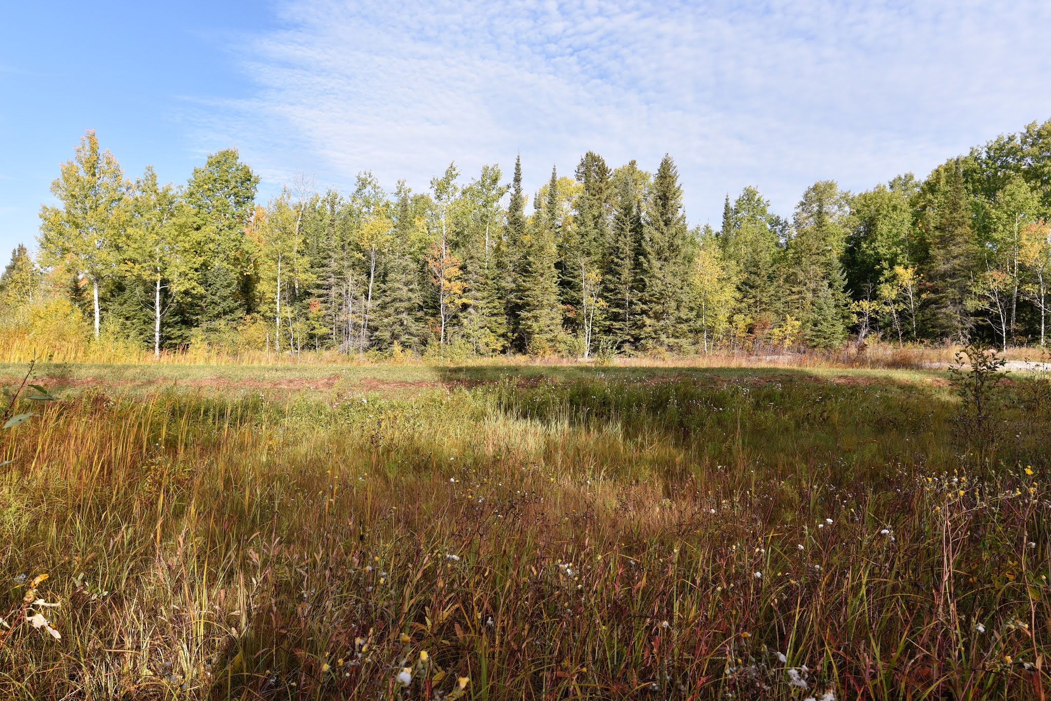
On the way to Otter Falls we crossed a very fancy, new-looking wooden boardwalk over a marsh and small pond. As we bounced over it we spotted two Painted Turtles stacked on a log in the sun on one side. Farther off were two small brown ducks with white bellies. Unfortunately they flew off before we could photograph or identify them properly. We noticed that the water level in the ponds we've been passing today have been 2-3 ft below where they usually are, making us wonder if there has been a drought this year.


About an hour into our hike we came to Otter Falls, which is where we had originally planned to camp yesterday. There is a provincial campground, resort, and store located on the lake there. We stopped at the Convenience store to see if there were any breakfast materials available, but sadly they were about to close for the season and had next to no stock left. Indeed despite the size of the store they had a total of 2 bottles of Coke, 2 Gatorades, and 1 bag of Doritos chips remaining for the season. Frustrated we walked on empty handed and without breakfast.


After Otter Falls the Great Trail began following the Maengun Trail, which was a cross-country ski route. It began as a wide, flat, gravel trail, which was easy to walk, but made us wonder why ski trails would be surfaced in gravel here.
We followed this beautiful trail until it became noticeably narrower and more overgrown. It took us through a stand of very tall deciduous trees that had already lost their leaves. Their rough grey stems rose up around us like a wall, and their dry leaves crunched underfoot, letting off the fresh, earthy smell of fall.


As we walked along on this section we spotted quite a few Wood Frogs. Many of them were tiny, struggling to jump through the tall grasses and weeds of the trail. Others were quite a bit larger, and some had a distinctly reddish tinge.
As we continued along we found ourselves in a beautiful landscape of exposed pink shield and glowing fall colours. However, by this point the trail signage had disappeared, and it was getting more and more challenging to follow the path. In some places we could see a trail of scattered gravel remnants, and in others the gravel had scraped the moss and lichen off the exposed shield, giving us a lighter pink track to follow over the bare rock. In other places we had to search in the tall grass, brambles, and thistles until we could make a guess as to where to go.


By this point in the afternoon it was pretty warm in the sun - about 27°C. We took a break on a rock and realized just how many hungry mosquitoes were out and about. The swarm that was feasting on us would have been typical of a mid-summer's day in Algonquin Provincial Park in Ontario, but wholly unexpected so late in fall.
Eventually we reached an access point for the highway. We stopped so that Sean could put the third batch of band aids on his beaten and heavily bleeding feet, and I investigated the trail ahead. It looked like we'd be able to follow it, so we continued on, around the shores of a beautiful blue lake. A flock of Wood Ducks took off from the far shore as we approached.


On the far side of the lake we picked up a lovely trail through a corridor of shady conifers. It lasted for about 50 m, and then we found ourselves in a muddy area that was full of deep wheel ruts. The trail was - for all practical intents and purposes - gone. We soon discovered a large beaver pond that had been drained, leaving behind a muddy basin. The dam had been partially opened up, letting the water flow through in a stream.


A new looking Trans Canada Trail footbridge spanned the created stream, but was stranded in the middle of the recently flooded area. We picked our way across the remains of the dam and then climbed up out of the mud onto the end of the bridge. I think in most normal circumstances this section of trail might have been considered closed for repairs.


After the dam we followed the unmarked track out to a narrow gravel road. We turned down the road and followed it to an open grassy area that had the remains of a railway line visible on the edge. There was a picnic table beside the old railway hut, right at the spot where the trail lead straight into a flooded quarry. We could see the rock walls rising up on all sides of the water, but the trail literally disappeared straight into the water.
The Trail Forks App showed the trail going through the water, as did the offline version of the Great Trail App. Of course there were no signs on the ground to help enlighten us. We searched around for a path and found faint traces of one leading off into the bush. It was going in the wrong direction, and we weren't sure if it was an animal track or an actual path.

We took a break at the picnic table and decided enough was enough. We'd spent several hours searching for remnants of gravel to follow through the tall grass and brambles. We'd crossed a muddy basin, a beaver dam, and a disconnected bridge. By this point we weren't willing to wade into the water to see if we could maybe detect traces of a footpath somewhere on the far side of a quarry of unknown depth. We had heavy packs and we needed to make some progress, so we backtracked down the gravel road and out onto the highway.
As we followed the narrow paved road west to the point where we could hopefully pick up the trail again the landscape seemed to change. Suddenly we were in a flat, wide-open marsh that seemed to extend out in all directions. A few poplars and aspen were visible on the horizon, but otherwise the rolling forested hills of the shield seemed to be gone.


A few kilometres farther on we came to the border of the Whiteshell Provincial Park. Just before we came to the sign thanking us for visiting we passed another sign for the Tim Horton's children's camp. We've seen adds for this camp at many Tim Horton's locations, and we always try to support camp day because it helps kids get outside. It was kind of exciting to see the location of one of the camps!
After leaving the park we followed a wide, level gravel track. Just as we picked it up a White-tailed Deer crossed ahead of us, diving into the trees only a few feet in front of us. As we continued we found ourselves in a landscape that alternated between grassy fields, open wet marshes interspersed with standing water and small streams, and stands of trees. It was very beautiful, and something quite different.


As we continued on through the hot afternoon we heard repeated shots ringing out through the woods. We weren't sure if they were from duck hunters or deer hunters, but whomever was out there was firing a lot of rounds and our pathway was full of old scattered shells that clattered under foot as we walked.


By late afternoon we reached the shores of Natalie Lake. At the western end of the lake is the large Seven Sisters Dam, which generates power for Winnipeg. The Seven Sisters Generating Station is the largest hydroelectric generating station on the Winnipeg River. Construction of the dam was begun in 1929 by the Winnipeg Electric Company, with the first power being generated in 1931. The second stage of construction began after WWII, in 1948. The present capacity of the station is 165 megawatts, which are used to power Winnipeg, Whiteshell, and Kenora, Ontario.


As we walked along the shores of the lake we saw kettles of Ring-billed, Herring, and Bonaparte's Gull. A very large immature Bald Eagle flapped along the shores of the lake. A small group of American Coots paddled among the grasses at the edge of the water. There were lots of waterfowl way out kn the lake, but most were to fr out to properly identify without a spotting scope. There may have been Common Mergansers, Common Goldeneyes, and Common Loons.


As we walked the gravel tracks today we also saw a lot of garter or ribbon snakes, and several red-bellied brown snakes. On the stretch of trail around the lake we must have found about ten separate snakes! Some of them moved very slowly, like they were frozen, even though today was very warm, but quite a few were extremely fast. In some places it seemed like it was hard not to step on them!
We seemed to walk for ages around the lake. We could see the large rectangular building of the dam at the far end, but no matter how much we walked we never seemed to get any closer. We were tired, hungry, hot, and discouraged. As we walked around the lake, high up on a raised berm, the wind blew dust in our faces and the sun beat down. We had an uneasy feeling we might have a lot more of this in our future as we cross the prairies.

We decided to walk into the town of Seven Sisters and have dinner at the Seven Sisters Motel and Restaurant. The milkshakes, omelette, and veggie skillet cheered us up and boosted our energy a little, but they also made us want to go to sleep. It occurred to us that we haven't taken a break since Thunder Bay, and we are both pretty tired. With the seasons again changing from Fall to Winter our time on the Trans Canada Trail this year may well be limited.
After enjoying the delicious meal, we stopped at a local convenience store for some bread and water. Clearly nervous of two people with backpacks on, the lady behind the counter asked Sean what we were doing, and he explained we were walking the trail, and that it went to Pinawa next, and Lac du Bonnet, and then Winnipeg. She said that didn't sound too bad, it was only 10 km to Pinawa, and 125 km to Winnipeg. Sean explained that by trail it was roughly three times that far. At first she didn't believe him. Then she tried to figure out why we would go north to go west. Then she, when she realized that we would not be simply trekking down the highway westward but instead venturing north simply declared 'You're an idiot'. Perhaps she isn't wrong. It is a different way of thinking, and very difficult to explain to a rational human with reasonable expectations. It is about the journey, not the destination. As more or less rational, reasonable people, we have to remind ourselves of this frequently.

After leaving the community of Seven Sisters we walked over the Seven Sisters dam. There was a beautiful view from the top. On one side was the deep, blue expanse of Natalie Lake. Far below on the other side was a rushing river with many large rocks poking up through the water. Shorebirds foraged along the edges of some of the rocky islands, but we could only see their outlines as we were looking straight into the sun at them. A Belted Kingfisher sat atop one of the rocks, fishing. Gulls wheeled overhead.


As we reached the far side of the dam we picked up the Pinawa Trail. The Great Trail signs reappeared, as well as maps with distances listed and 'you are here' indicators. It had been since the South Whiteshell Trail section that we'd had these luxuries.


We continued along the raised gravel road around the lake until we found a spot to camp. There were a lot of deer tracks in the sand, and as I write this I can hear something large crashing around in the marsh next to us. The stars are bright overhead, and the warm wind is still rustling in the aspens.
See you on the trail!
Remember to follow our entire adventure here : www.comewalkwithus.online
Comments
Post a Comment