Crepes, Cakes, and Industry : Chambly to Longueil
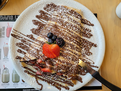
Today began in the very best of ways - with a celebratory breakfast in honour of our last full day of walking the Sentier Transcanadien this season. Before heading out we stopped at l'Oeufrier, where Sean enjoyed a delicious omelette and I had one of the largest strawberry, banana, and Nutella filled crepes I've ever seen! I don't imagine today's hike is nearly long enough to burn through all those calories, but it was well worth it!

When we finally got under way around 8:00 am it was already a very warm morning. In the soft early light we could see across the waters of the Bassin de Chambly to the hills and mountains in the distance. Along the shore behind us the solid stone walls of Fort Chambly stood tall, a quiet reminder of times gone by. It's original occupants could never have imagined a time when people in brightly coloured spandex would jog around its walls for fun or exercise before heading to work, joined by people walking dogs of all shapes and sizes.


We made our way down a paved footpath running between the water and the shops and restaurants of the main street, many of which had outdoor patios or covered verandas overlooking the water. The pathway was lined with trees, ornamental grasses, pergolas, and stone pillars topped with metal plaques featuring the poetry of local artists. Once again, we were treated to an inspiring mixture of art and nature.

The trail wove through downtown, past the impressive red brick town hall, which
had a large stone monument and brass statue dedicated to the memory of
Lieutenant Colonel Charles-Michel d'Irumberry de Salaberry (1778 - 1829).
This distinguished gentleman was a Canadian military officer in the British
Army, and served as a statesman of the seigneurial class. He won
distinction for repelling the American advance on Montreal during the war of
1812, and he died in Chambly in 1829.


Also outside the town hall was an iconic red British telephone booth that had been turned into a Little Free Library. What a cool idea!
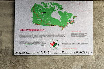


Another point of interest was a Trans Canada Trail pavilion located on the edge of town. Like the last one we passed it had been stripped of most of its plaques, we assume because it is scheduled to be updated with the new logo.


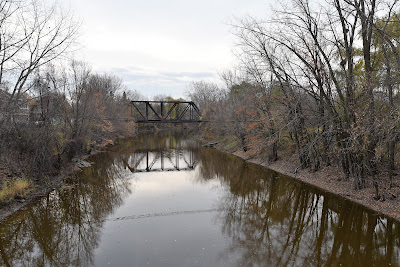
We passed a wooden pedestrian bridge over the small Rivière L'Acadie, which we were delighted to see had a Tree Swallow box installed in the middle, and a sign indicating that it was part of the 'Parcours des nichoirs' or the 'Birdhouse Trail.' This trail was established by the town of Carignan and includes 115 nest boxes that support 11 bird species, as well as 23 identification points where trail users can scan a QR code to learn more about the birds included in the program. Some of the species who have been provided with nest boxes as part of this initiative include Tree Swallows, Wood Ducks, Barred Owls, and Osprey.


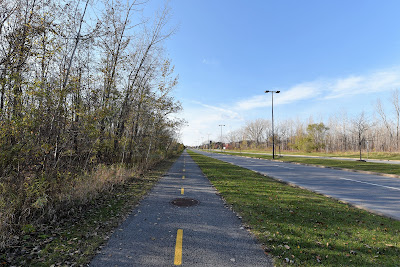
After crossing the river we walked along a paved bicycle path for the next 7 km or so. Although we were less than 30 km outside of Montreal by this point, we still found ourselves surrounded by green spaces. For a while the path traversed stands of deciduous forest, and at other points we crossed fields of harvested corn or wild cattail marshes, many of which were being overgrown with phragmites. These natural areas were interspersed with small subdivisions, and we were passed by many cyclists and a few joggers in this stretch. Although it felt like we were in the countryside, suburbia wasn't far off.


Eventually the trail emerged onto the side of a rather busy road with homes on one side and fields on the other. Once again we were grateful for the paved cycling lane that separated us from the rush of traffic. Gradually the roar of the A-30 highway grew louder until finally we passed underneath it. For a few more blocks our surroundings alternated between small housing developments and forested patches, and then we entered a densely populated neighbourhood that marked the beginning of the St. Hubert. For the rest of the morning we essentially wove through neighbourhoods on city streets until we came to the Saint Lawrence Seaway.


One highlight was walking through the Parc de la Cite in Longueuil. This 1 square kilometre nature park encompasses a number of different habitats, including a grassy plain, deciduous woodlands, a large water retention basin, wetlands, and a peat bog. The diversity of habitats supports a wide range of different birds, with over 204 species having been reported on eBird.


Visitors can explore the park on 8 km of asphalt trails which can be traversed on foot, by bicycle, on roller blades, snowshoes, or cross-country skis. There is also a large pavilion and a very fun looking sledding hill in the park. As we walked along the edge of the park we passed the sledding hill, and stopped to admire a graceful turquoise bridge that spanned the pond, which was full of Ring-billed Gulls.

From there we had another walk through neighbourhoods, and then a stretch of trail running underneath a power corridor. The paved cycling path was bordered by an open grassy area, and on both sides of that were homes with treed lots. Later on the surroundings changed to a somewhat aesthetically unappealing industrial park. It reminded us a lot of walking into other large cities across Canada, including Toronto, where you go from countryside, to golf course, to hydropower corridor, to busy highways, to industrial parks, to dodgy business parks, to lower income neighbourhoods, to wealthy neighbourhoods, to the downtown. Once again, we were grateful for the paved cycling path that kept us in a pretty nice green corridor for much of the walk, and was very well marked, easy to follow, and provided safe ways to cross the busy highways and roads. Although the anatomy of cities across the country is similar, in many cases the walk is much less pleasant.
One of the ironies of today's walk was that although we were in a densely populated area, there weren't a lot of places to stop for a coffee or snack along our dedicated cycling corridor. Eventually we stopped at a gas station convenience store for a cold drink. It was around lunch time, and the store was nearly overwhelmed by high-school kids who unfortunately seemed to be up to no good. Large groups of them with open school packs would swarm inside while their friends sat outside cheering them on and waiting their turn. The adults outside also seemed a little sketchy, although admittedly we were probably the most sketchy of the bunch.
As Sean left me with the backpacks and went into the store get us cold drinks three men got out of their nearby car, positioned themselves around me and proceeded to shuffle and ‘bump against’. After seeing one of them try to 'casually' pick up Sean’s backpack before discovering its daunting weight and while feeling another of them behind me clearly trying to undo my backpack straps I put my back to the glass front of the store, held onto the top of Sean bag and waited patiently. When he finally emerged he noticed the ring of men around me, walked over and single handedly picked up his 60 lb pack and slung it over only one arm - which seemed to startle those near by - and we quickly proceeded onward down the trail. A few minutes later we enjoyed our iced coffees on a bench farther down the hydro corridor where we figured we could avoid trouble.

As we made our way though the outskirts of Montreal the trail became increasingly busy, and we began to notice something interesting. The paved cycling path has two lanes, divided by a painted yellow line, and we haven't been sure which side of the trail we (as slow moving pedestrians) should be using. In the sections around Quebec City and later in Waterloo there were signs telling us to walk on the left, facing the oncoming bicycles. Yet here we noticed that joggers almost always travel with the bicycle traffic, but in this stretch walkers seemed to distribute themselves at random. In some neighbourhoods people walked with the bicycle traffic, and in others they were all walking against it. It felt like there was an unspoken set of rules that fluctuated locally, and which we could only learn by observing others. Adding to the confusion motorized chairs and e-scooters seemed to race through of their own accord with no acknowledgement of the rules of the pathway. As such, the strict codes and respectful manner of which side we were to trek on, and how to navigate the pathway which we have followed since Sentier des Caps seemed to shatter as we approached the urban centre in front of us.

After the hydro corridor we crossed another very busy highway on a pedestrian bridge which arched high up over the traffic. As we climbed up the long wooden ramp we got our first glimpse of the tall arm and large white dome of the Olympic Stadium across the St. Lawrence River, the tall skyscrapers of Montreal's skyline, and the enormous port and shipping terminals along the waterway.


The bridge spanned not only the highway but also a large train yard, and it was interesting to see the lines of trains sitting below, and to realize we've walked along many kilometers of the corridors they follow across the nation. Right in the middle of the white metal bridge a Sharp-shinned Hawk was perched on a lamp post, as if welcoming us to its domain.


After our brief glimpse of the coming attractions we descended a long spiral ramp back into another green corridor. Although we could hear the noise of the highway beside us, we were walking in a pleasant green space. Black-capped Chickadees and Dark-eyed Juncos flitted about in the trees, and Grey Squirrels busily buried nuts in preparation for winter.


After our brief interlude we wove back into the upscale neighbourhoods of Longueuil. We followed a sidewalk past modern subdivisions and condos, a mall, and several schools. Although our walk through Quebec has been on the Route Verte, which passes through many small communities and some larger ones, finding ourselves surrounded by so much fast paced movement and noise from the cars, trucks, city buses, and cyclists after a few weeks in the countryside was a little overwhelming.

A highlight of the late afternoon was walking through the Parc Michel-Chartrand. This 1.85 square kilometre nature park and conservation area features nearly 20 km of cycling routes, hiking pathways, and cross-country trails, as well as a pavilion, a sledding hill, three artificial lakes, a marsh with an observation platform, a playground, a sundial, a community garden, and more. Best of all, it offers an opportunity to be completely immersed in nature while standing in the middle of a city.

As we wove our way through the network of forested trails we passed many people out enjoying a pre-dinner stroll on the warm, sunny, afternoon. With only a few hours of daylight left we didn't stop to linger, but we did manage to spot several White-breasted Nuthatches, lots of Black-capped Chickadees, Blue Jays, American Robins, American Goldfinches, Dark-eyed Juncos, a Downy Woodpecker, a Golden-crowned Kinglet, and several Song Sparrows. It was a wonderful nature interlude in today's urban walk.

We eventually passed through a rounded metal underpass at the edge of the park and found ourselves in another suburban neighbourhood. We were still following the paved cycling path, which followed a treed green corridor between the fenced backyards of subdivisions homes. We were amazed to see what must have been nearly a thousand small saplings along the pathway, each wrapped in protective mesh to shield them from grazing White-tailed Deer. It is possible this impressive initiative was part of the plan to plant 50,000 trees in the region, or it may have been part of the management plan to replace damage done by the emerald ash borer in and around the Parc-Michel Chartrand.


When we reached the shores of the Saint Lawrence River we were separated from it by the four-lane Boulevard Marie-Victorin and the incredibly busy eight-lane Avenue René-Levesque highway. We walked up a steep and slightly vertigo-inducing spiral bike ramp that led to an overpass which transported us safely over the non-stop, roaring, rush-hour traffic below us. On the far side we descended again onto a tiny strip of green wedged between the highway and the Saint Lawrence Seaway.


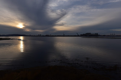
As we made our way along the paved cycling path the pale yellow sun was sinking fast towards the horizon in a soft pastel sky that resembled a watercolour painting. Across the water we could see the huge Port of Montréal, which from that distance seemed to be quiet and devoid of life. Around 2,000 cargo ships pass through the port annually, handling 40,500,000 metric tons of consumer goods, including machinery, grain, sugar, petroleum products, and other materials. The international container terminal services Toronto and the rest of Central Canada, the US Midwest, and the US Northeast. Although it is 1,600 kilometres inland from the Atlantic Ocean, it is still located on the shortest route between Europe's ports on the Mediterranean and the North American Midwest, and it is estimated to contribute around $1.5 billion in economic benefits to the Canadian economy.


Not long after beginning our southward walk along the shores of the Saint Lawrence we passed a treed point with a small, somewhat dilapidated looking white and red lighthouse perched out on the end. The Range Lighthouse was located in the Longue Pointe neighbourhood of Montréal, where an important battle of the Revolutionary War was fought in 1775.

Ethan Allan, an American who earlier that year had captured the French Fort Ticonderoga on Lake Champlain, attempted to seize control of Montréal by launching a surprise attack from Longue-Pointe. Word of his intentions reached General Guy Carleton, the British governor of Quebec, in Montreal, and the attack was stopped. Ethan Allen was captured and held by the British as a prisoner of war, but was then returned to New York, and eventually traded for the return of Archibald Campbell, a British officer.


As we passed through the treed riverside Parc de la Point-du-Marigot in the rapidly fading light we could see grassy marshes extending out into the river, almost joining with the long, thin, completely undeveloped island sitting offshore. This tiny piece of land was one of four artificial islands that were created when the canal was dredged and have now been designated as the Île de la Couvée Important Bird Area. These islands support over 10,000 pairs of breeding Ring-billed Gulls, which accounts for 1-3% of the global population of this species. Herring Gulls and Common Terns have also been observed nesting on these islands.
Soon after this we came to the Passerelle Normadie, which was another pedestrian and cycling overpass. Although the Sentier Transcanadien continued down the seaway towards Montréal, we crossed back over the highway in the fading light, heading over to our accommodations for the night. We climbed another tall spiralling ramp, this one painted a lime green. A tall wooden tower with 'Longueuil' written on it rose above us. Although we hadn't seen many people on the pathway until this point, a few others were winding their way up the ramp, and a small group of cyclists was congregated in the park at the base of the overpass.


As we crossed back over the busy highway, we could see the un-symmetrical spires of the Cocathédrale de Saint-Antoine-de-Padoue silhouetted against the sunset. The site contains the remains of Fort Longueuil, which was constructed between 1685 and 1690 as the residence of Charles le Moyne de Longueuil, the only Canadian born person to be given the rank of Baron by the King of France. Fort Longueuil was demolished in 1810, and some of the stones and other materials salvaged from it were incorporated into the cathedral. The site was designated as a National Historic Site of Canada in 1923.
We made our way through busy neighbourhoods, back to the Holiday Inn, where we are spending tonight. Although we are only 17 km from downtown Montréal, we decided not to continue walking on in the dark, and in addition, accommodations are less expensive here than in the downtown area. I imagine this is how it must feel for pilgrims on the Camino Frances, who stop in Monte de Gozo - just 8 km from Santiago de Compostela. We can see the lights of the city where we will end this season on the trail twinkling across the water. The goal is so close it feels like we can reach out and touch it, and yet we have one more night to wait.

The staff at the Holiday Inn were incredible, and even offered to do our laundry since the coin operated machine was being repaired. Perhaps this was a hint to us, but their professionalism never wavered. We took the glass-walled elevator up to the sixth floor, enjoying a bird's eye view into the enclosed centre of the building where a wooden model of an RCAF biplane was suspended above the elegant central bar below. We were surrounded by glass, leather, dark polished wood, and pristine white linens. The patrons of the bar below were attending a realty conference, and were boldly sporting what we can only assume are the latest fashions in business attire - extremely tight fitting plaid suits that were so short they left the ankles and the bright pink, green, or orange socks of the male owners exposed. There is no way to adequately describe how out of place we felt with our worn, dirty, and tired expedition gear in these posh and anonymous urban surroundings.

It feels like the transition from long-distance hiker and active explorer who is engaged face to face with the real world out on the trail has already begun, and office work is once again only a few short days away. As we sit here, enjoying our last night on the trail, we are left with a lot to reflect upon.

See you on the trail!
Remember to follow our entire adventure here : www.comewalkwithus.online
Comments
Post a Comment