Always Hardest Near the End : Granby to Saint-Gregoire
Yesterday Granby seemed to us like a geographical anomaly, and today it felt like a temporal one. We forgot that daylight savings time was set to end last night, and spent an hour this morning wondering why the alarm clock wasn't going off when it was clearly already light outside. That alone is a good indicator of just how tired we are at this point in the adventure.

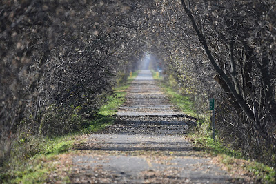
After a delicious breakfast of crepes and omelettes, we set off into a sunny Sunday morning, making our way back through Granby to the trail. A short walk through a still sleepy neighbourhood brought us back to the paved cycling path that is both the Trans Canada Trail and the Route Verte here in Quebec. For the next few kilometres the crisp fall leaves crunched under our feet as we made our way along under a corridor of trees. Through the tree trunks and bare branches on either side of us we could see warehouses, trucks, and other signs of an industrial park.


Eventually the trail brought us out into the countryside, where we found our first obstacle of the day. The first indication of trouble was a row of orange pylons blocking the trail, which we could see from about 2 km away. When we finally reached them we discovered a 'Route barée' sign, accompanied by an arrow indicating a detour. Oh. We looked at Google maps and learned that the detour would add over 5 km along the side of a busy highway to a day that was already scheduled to be over 40 km long. Instead we decided to continue moving forward down the trail and see what was what.


We made our way between emerald green fields, and then walked into a stand of mature maples trees. Overhead a Red-tailed Hawk gave its iconic scream, and somewhere in the canopy a Blue Jay gave a loud complaint. We could see an obstruction on the trail ahead, as well as the very busy highway crossing over the trail. It turned out that some work was being done on the trail bed at the point where it crossed under the highway. Although the trail was well and truly blocked by fencing, machinery, and construction materials, we found our way around the obstruction, albeit without much dignity or grace. Both of us where grateful that it was a Sunday so that no one on the work crew was around to witness our scrambling and frustration. Regardless, 25 minutes of climbing, hauling, and crawling over and under construction materials we had succeeded in not having to add kilometres to our day.


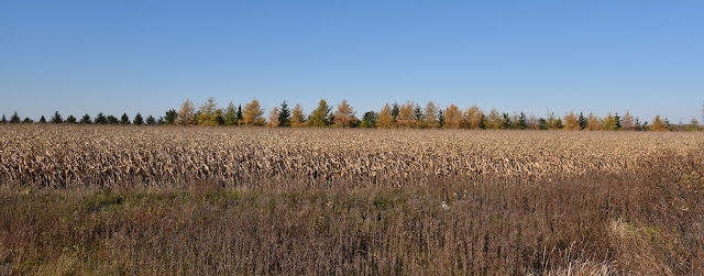
After this minor adventure we found ourselves out in the countryside, where we remained for much of the day. The landscape was a patchwork of emerald green hay fields, light blond corn fields, rich dark brown squares of newly ploughed earth, and stands of deciduous trees where the warm yellows, oranges, and coppery browns were still visible. Small farms with iconic red barns and tall grain silos dotted this pastoral landscape, and the air smelled of fresh earth, manure, and hay.


We passed a farmer out harvesting his corn, and several chicken farms. A field of rich brown earth was sprinkled with light coloured potatoes. At a crossroads we passed a retired couple working hard on building a new wooden Halte Velo shelter and were in the process of mounting a Grand Sentier logo on the side of it. We were a little surprised to see that the trail in this area is once again marked as the 'Great Trail' and that the signage hasn't been switched to reflect the recent re-branding, especially since it is so close to the Trans Canada Trail headquarters in Montreal.


Not too long after the re-route we spotted a hunter coming out of the woods. He emerged onto the trail just behind us and immediately picking up his pace to follow directly behind us for about a kilometre with his rifle pointed in front of him and consequently at our backs. It was an odd feeling to have an armed stranger marching quickly on the trail behind one. Within the next few kilometres we encountered two more hunters walking across a harvested corn field and pulling the spoils of their efforts behind them on a wheeled cart. When we arrived at their truck they were just loading the third white-tailed deer carcass into the back. As we passed by both of us quickly glanced up, noticed the haunting and vacant look in one deer’s empty eyes and quickened our pace.

A little farther down the trail we took a break at a picnic table which was sheltered by the strip of trees on either side of the trail. We could see hunting blinds at the edge of the woods across the open fields, and shots continually rang out nearby. To our dismay we spotted a group of five white-tailed deer gracefully bounding across the open fields towards the woods. We silently wished them well as we continued onward, but a few minutes later the telltale sound and echoes of shots recoiled through the region. Sigh...


Shortly after noon we arrived in the community of Farnham. When we reached the edge of town we were momentarily confused by a brand new section of paved trail that ran counter to the TCT app, the Route Verte map and the posted signs. As such, we followed the Route Verte signs out to the road, where they seemed to disappear, only to discover we were going the wrong way, and when we turned back we discovered the new unsigned trailway.

We followed the road past a very busy nature centre, which looked like a large treed park with many forested trails. When we went to cross the Yamaska River, we found the second obstruction of the day - the pedestrian bridge by the dam was gated off and blocked. With few other options, we continued on down the river, crossing the water on the road. On the far side was a park with a much larger than life Adirondack chair and a beautiful view down the river.
Farnham was founded in 1800 by Loyalists who came north from the US, and it was named after Farnham, UK. Today the town has around 8,000 residents, and it is the site of an important military training camp, used primarily by the Canadian Forces Leadership and Recruit School.


We had been hoping to stop for a coffee and a bite to eat, but sadly many of the stores and shops along the main street were boarded up, and those that weren't more permanently shut down were closed on Sunday. To add to our dissatisfaction, as we detoured through the town back to 'our' trail it seemed like nearly every street was marked as part of the Route Verte, which made navigation pretty confusing. As we ventured through town we were stopped by a middle aged man who was curious about our backpacks, asked about our trek and wildlife sightings, but also gave us our now daily reminder that we could not camp along the route and must be in a gite, albergue or motel at night.

We wove up and down through the city streets and neighbourhoods on the Route Verte before picking up the paved cycling trail once again and heading back out into the countryside. As we crossed the highway at the far edge of town we counted no less than 15 signs on the edge of the trail, providing directions and warnings about crossing the highway (prepare to slow down, stop, beware of bump, respect social distancing, push the button and wait for the signal to cross, remember you are not the priority, and you are one the Route Verte and Grand Sentier trails, among others). The trails in Quebec are extremely well marked, but at times it strikes us that we have an awful lot of instructions just to keep moving forward. Taking photos along the trail without an unsightly signs in them is next to impossible. Though it is fun to watch Sean try each day.

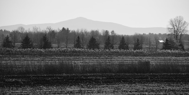
We walked past the local airport and Montreal Parachute Club, and then began a section of trail that boxed around the edges of several fields. We could see a long freight train across the open landscape, and hear the engine getting warmed up and ready to begin pulling the long line of railway carriages. In the distance we could once again see lines of rolling hills and mountains, lit by the afternoon sunshine.


During the morning we saw only a few other hikers and cyclists, but by mid-afternoon the traffic on the trail really began to pick up once again. We were passed by many cyclists out for a Sunday ride, as well as quite a few walkers, especially within 5 km of Farnham. One of the highlights was a group of about 25 pélèrin, many with small backpacks and walking poles, who were making their way towards Saint-Anne-de-Beaupré. There is a 215 km pilgrimage from Montreal to Saint Anne, so this group must have just been starting out on their journey. We couldn't help but be a little envious of the companionship.


At one point we crossed a road which from our perspective seemed to be in the middle of nowhere. However, the parking lot for the trail was filled with cars, and the trail was busy with people. One family, who was walking their dog and playing football on the trail, stopped to chat and ask us where we were hiking from. They were very enthusiastic about our project, and very kindly wished us well.


We had walked about 25 km to Farnham, and we had another 16 km after that to reach Saint Grégoire, where we are staying for tonight. It was quite simply a peaceful and beautiful walk through pastoral scenery.


Around 3:00 pm as the sun began its descent the temperature began to drop, and around 4 pm the sun began to sink down the treeline with somewhat unexpected speed. Interesting cloud patterns in the pale blue sky came alive with colour as the sun set.


Just as we were losing the last of the light and feeling the length of our trek we came to the turnoff for the Gite du Colibri Saint-Gregoire Quebec. We found this place using the Route Verte interactive map, which is an indispensable resource for anyone walking the Trans Canada Trail in Quebec, or for anyone cycling across the province. The map shows cyclist friendly accommodations along the trail, together with a list of amenities they offer (like showers, laundry, and breakfast), places to eat, and sports stores where gear replacement and bicycle repair is possible. It also shows up-to-date trail closures and conditions.
If only every province provided this much up to date information or the TCT’s own app worked half as well!

We found ourselves in a lovely apartment with its own entrance, a kitchenette, and a balcony. The owner of the Gite spoke only French, but she was very friendly and helpful, and we managed well very. The fridge was stocked with the makings of a huge breakfast, including bacon, eggs, toast, yogourt, and fruit, and the there were even two chocolatines in ziplock bags for the trail tomorrow.

It was good ending to a very long day. As of tonight we have just four days left until we reach Montreal (fingers crossed)!
See you on the trail!
Remember to follow our entire adventure here : www.comewalkwithus.online
Comments
Post a Comment