A Short Hot day : Riel House to St. Norbert
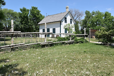
After visiting this historic landmark we threaded our way back through the subdivision to the paved bike trail which then lead us to a local park complete with a beautiful duck pond.
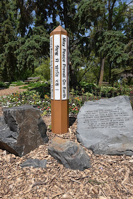
In St. Vital Park we were fortunate to see White-breasted Nuthatches, Ring-necked Ducks, Mallards and Canadian Geese. Our trek through this green space also brought us to a series of posters for 'A Walking Awareness Campaign' focused on raising awareness and educating residents about the mistreatment of Indigenous peoples across Canada following European settlement with the hope of taking effective steps for reconciliation in the future.
After a very short stretch where the trail paralleled the highway we once again turned into a quiet neighborhood, walking along the edge of the Red River.
The Red River is a Canadian Heritage River that is about 885 km long. It begins at the confluence of the Bois de Sioux and Otter Tail Rivers between North Dakota and Minnesota, and it flows northward into Lake Winnipeg, ultimately continuing to Hudson's Bay as the Nelson River. It was an important trade route for Indigenous communities before European settlement, and later was used by fur traders, including French and Métis people, working for the Hudson's Bay Company.
As we were walking along the sidewalk, enjoying the warm, sunny morning we met Ian and Donna, who stopped to ask where we had hiked from. It turned out they were avid birders who knew about our #hike4birds, and they had also randomly met Mel Vogel when she hiked through two years ago! Also, it turns out Ian was a glass blower who made scientific equipment for the Chemistry department at the University of Manitoba, which is a rare skill. How cool is that?
This lovely couple walked with us through the University of Manitoba campus, sharing interesting tidbits of local history, as well as stories and tips about the Crow Wing Trail and other trails we'll encounter along the way. They had an in depth knowledge of the circuitous route of the Trans Canada Trail, which is unusual in our experience. They also shared stories of local spots to go birding, and told us that climate change has recently brought nesting Bald Eagles, Northern Cardinals, and House Finches to southern Manitoba, which used to be extremely rare. Chatting with these lovely people really made our morning!
On the far side of the university campus, just past the building where canola oil was first discovered, we again wove through a quiet neighbourhood of custom designed homes on deep, treed and landscaped properties. A short walk down sidewalks brought us to Kings Park, a 37.4 ha park along the banks of the Red River.
We skirted the edges of this beautiful park, following a band of natural vegetation next to the river. As we walked the shady footpath we heard the familiar songs of Red-eyed and Warbling Vireos, watched White-breasted Nuthatches climbing tree trunks, listened to the drumming of a Hairy Woodpecker, admired the brilliant plumage of an Indigo Bunting, and searched flocks of Red-winged Blackbirds to see if there were any Yellow-headed Blackbirds among them (sadly there were not).
Eventually we came to a garden with gravel paths forming a labyrinth at the edge of a dry 'pond.' At the far side was a red lacquered Chinese pagoda, and we'd just learned from Ian and Donna that the red arched bridges that used to cross the waterways beside the pagoda were the same ones we'd crossed in the wilds of Whiteshell Provincial Park. The arch of these fancy wooden bridges was too steep to be easily accessible, so they were relocated (by helicopter) to another section of Trans Canada Trail, and replaced with more accessible alternatives in Kings Park.
We enjoyed making our way through the large, landscaped, grassy park and we stopped to chat with a few more people along the way. Since beginning our hike again this year we've realized how much our own altitude and energy levels affect our perception of a place. When we arrived in Manitoba at the end of 2020 we were completely (and somewhat inexplicably) worn down, and we had the warped perception that Manitoba was an unwelcoming place for us, where everything was going wrong. There wasn't any evidence to support this, but our own exhaustion and the endless online nastiness got the better of us. Since returning we've been met with overwhelming kindness, and we've been blown away by how friendly everyone is here. Today was just another reminder of how much better an experience is when you're able to take a break and recharge and see things with fresh eyes.
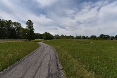
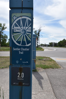
At the far edge of King's Park we dove into the Fort Richmond subdivision once again, following a winding road that mirrored the contours of the river. As we ducked under the highway once again we picked up the paved Sentier Cloutier Trail, which was a beautiful cycling trail bordered by trees and green spaces.
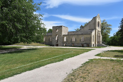
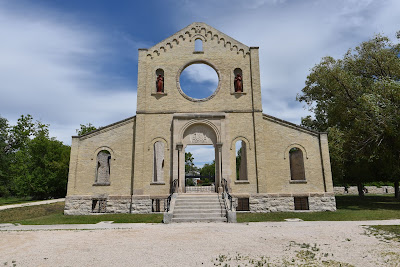
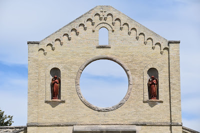
Since today's walk was pretty short we took another detour to visit the Trappist Monastery Provincial Park. The sand coloured brick and stone remains of the Abbey of Our Lady of the Prairies are located in the park, it's Romanesque Revival style walls standing peacefully on the treed hills above the river.
It was established by five Cistercians of the Trappist Order from the Abbey of Bellefontaine, France in 1892. The church and connecting wing were built in 1905, and the adjoining guest house was built in 1912. The self-sufficient monastery included milking barns, stables, a cheese house, apiary, sawmill, and cannery. By 1978, the Trappists moved to a location near Holland, Manitoba to protect their quiet lifestyle from urban sprawl, and in 1983 the church burned down.
We also took the opportunity to look for birds along the river-way were we saw Franklin's Gulls and Savannah Sparrows.
See you on the trail!
Remember to follow our entire adventure here : www.comewalkwithus.online











Comments
Post a Comment