Mountain Bike Paradise : Inglis through Asessippi PP
This morning we headed out of Inglis on the Marsh Boardwalk and Interpretive Trail - the local portion of the Great Trail. This charming little forested track took us across a small field, along a short section of railway where the ties and rails hadn't been removed, and through a shady aspen forest to a small wooden lookout over a tiny marsh.


There were interpretive signs along the way describing the importance of wetlands, native plant species, and invertebrates among other interesting things. In the unfortunately dry marsh we spotted Lesser and Greater Yellowlegs foraging in the mud, Red-winged Blackbirds calling from the cattails, and a Cedar Waxwing uncharacteristically perched on a post in the midst of the marshy area. Otherwise it was pretty quiet.

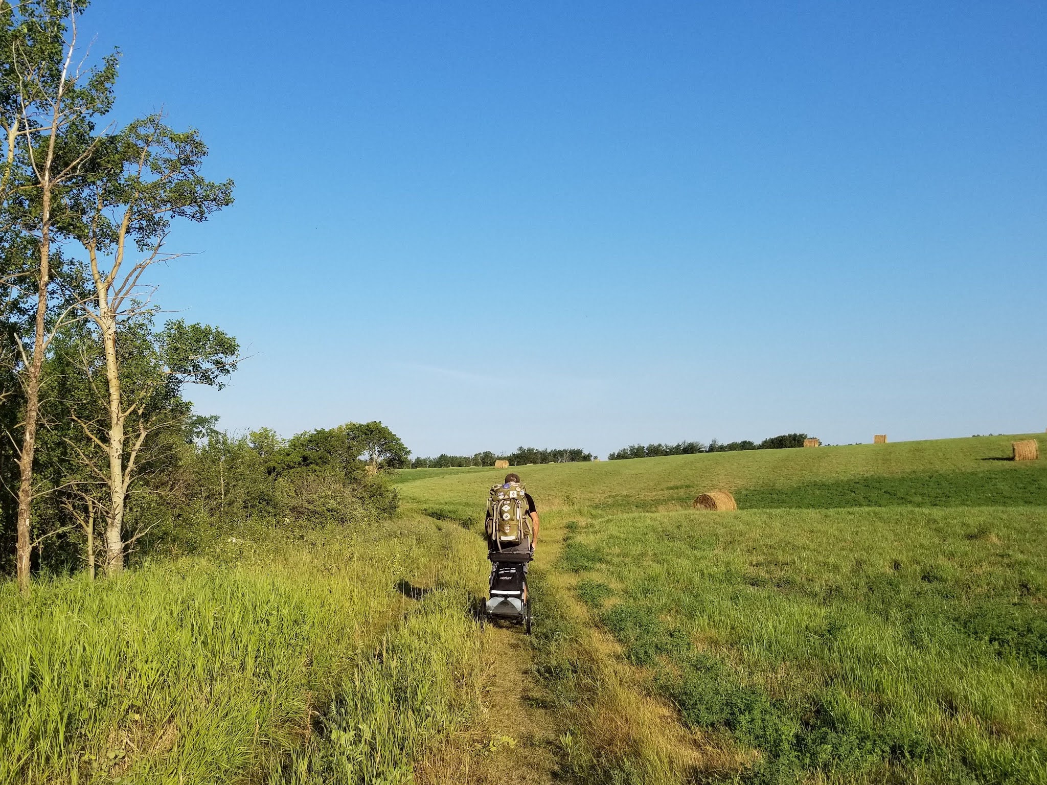

At the edge of town we walked past a small school with a colourful mural showing the children and their parents, and then headed north on a gravel concession in a bright and sunny morning which was already turning hot. About 3 km later we turned onto a mowed grassy track that took us along the treed edge of a hay field to the trail-head for the Bear Creek Model Watershed and Interpretive Trail. The sign suggested we were about to begin a 5.5 km hiking trail through the Bear Creek Valley, that would connect the landscape bordering Riding Mountain National Park with the Shell River Valley.


As we passed the trail-head we saw a stunningly beautiful forested valley stretching out before us, the sun lighting up the tree canopies on the sides of the incredibly steep, deep, and winding valley. We paused to enjoy the view for a few moments, then focused on the trail ahead.

The first 20 m or so were straight down the side of the valley on a loose dirt ATV track. After being pulled down it in a somewhat terrifying and completely uncontrolled slide, I decided to transfer as much weight from the cart into my pack as I could fit. Unlike the last mountain biking trail in Tinkers Creek, where the straight ups and downs were about 10-15 ft high, these were more than twice that high.


We soon found ourselves climbing back up a very narrow, steep track, and then sliding down a slope of shale. It was loose, sharp, and there was no way to stop, slow, or direct our descent. We must have looked like cartoon characters trying to get back up the other side - taking one step up and sliding backwards down. Taking two running steps and sliding backwards down, because there was no solid ground to get a grip and the carts pulled us backwards. To add to our difficulties, a little ways in we became lost in a network of criss-crossing mountain bike and ATV tracks, and we were no longer confident we were following the right track.
We struggled along like this for just over 2 km, winding up and down the sides of the valley. Even without gear, I would rate this trail as 'Difficult' or 'Very Difficult' for hiking on account of the steep slopes combined with the loose soil and shale. To my uninitiated eyes, the constant and winding ups and downs looked like a fantastic trail for mountain biking or fat biking, and this was confirmed by a very friendly cyclist we met halfway through who warned us to be careful, that cyclists wouldn't expect hikers and they could be coming very fast in some sections where they wouldn't be able to stop.


At one point the trail took us all the way up the side of the valley to its lip, and we walked down a forested field edge to the road and out to the highway.

We felt utterly defeated and discouraged that once again we were walking a road instead of enjoying a beautiful green-space, but on the eve of our departure from this province it confirmed something we've been feeling for a while. This landscape and its trails are places of extremes. We've walked flat, straight, gravel concessions with no technical challenges at all and we've hiked extreme mountain biking courses in steep river valleys. Outside of Winnipeg and the municipal and provincial parks, we've found little in between.


Having trekked the roadway for 2 km we relocated the other end of the Bear Creek Valley trail which we trekked 1.5 km eastward along only to find knee and waist deep grass with few indicators of any recent use.


Feeling somewhat redeemed for having trekked the majority of the Beer Creek section we crossed the road and came to the boundary of the Asessippi Provincial Park. This 23.2 square kilometre park is named after the town of Asessippi, which was established in 1882 on the edge of the Shell River. Asessippi is a Cree word meaning 'clam shell river.' The park was established in 1964 as part of the creation of the Shellmouth Dam and its reservoir, the Lake of the Prairies. This lake now offers anglers opportunities to catch walleye, northern pike, and yellow perch among other things.


The park is situated where the valley of the Assiniboine River meets the valley of the Shell River. The landscape was shaped more than 10,000 years ago by the melting of the Keewatin Ice flow, which was part of the Laurentide Ice Sheet. The modern versions of the Assiniboine and Shell rivers are examples of 'misfit rivers' because they are much smaller, and meander far more than the large river valleys in which they are located.


The Asessippi Valley is now also home to the Asessippi Ski Resort, which offers mountain biking in summer and 23 ski runs, a downhill snow tubing park, and a terrain park that are serviced by 3 chair lifts. There is a large chalet and a ski village located nearby as well.
After the brutally exhausting hike this morning, we were delighted to find a wide, closely mowed grassy trail under a canopy of shade trees at the edge of the park. The trail led us down to the shallow, meandering river at the bottom of the forested valley. Along the way we passed several picturesque abandoned wooden buildings, as well as a couple interpretive signs. There were a few muddy, uneven patches, but overall this section of trail was beautiful, and it offered stunning views down the valley and across to the ski hills. Unsurprisingly, we passed a few other people enjoying the sunny afternoon on the banks of the river.


Eventually the hiking trail led us out to a gravel road that ran along the bottom of the ski hills. We passed all three chair lifts, seeing a couple mountain bikers as we went. As we approached the chalet the trail was supposed to pick up again, and take us back down to the river, but the signs seemed to disappear, and we failed to find the trail-head. We asked one young man working on the winter grooming machines where the TCT was he responded that they had "sold the land and that the trail was gone". Undeterred we continued down the winding road, which was quite hot now in the bright afternoon sun.


At the far edge of the park we came out onto a gravel concession road and wound back down to the river, where we passed a floating dock with several colourful boats at the Cottage Cove Marina. As we passed the other end of the trail we were originally unable to find we saw a notice saying the trail had been rerouted, and hikers should check at the ski chalet while another posting told trekkers to take the road to Inglis. There had been no such notice on the other side. Hmm.

It was then time to start making the long, steep, climb up out of the river valley. Part way up the hill the trail led off into the woods along the forested river valley once again. It was a multi-use ATV track - with the entrance blocked by a parked truck and presently filled with a number of ATVs who could be heard racing along the pathways. While this pathway was in good condition, the fact was by this point we were too hot and tired to enjoy weaving our way up and down the sides of the valley while also regularly diving off the trail to avoid the motorized traffic for another 10 km. One thing we learned today - although we haven't met any hikers so far outside of the beautiful trails running through Winnipeg, Manitoba hikers must be really hard core! By the end of this short day of trekking we were bone weary. No wonder our hosts had suggested crossing the three sections of this river valley would take several days!


At the far edge of the park the trail emerged onto a mowed grassy track that ran beside a hay field. Although we had only covered 23 km today, and it was only 4 pm, we were too exhausted to continue. The weather network indicated it was 31 °C, but the sun felt scorching hot. We sat down in the shade of the trees along the trail edge and listened to the rustle of the wind in the aspens. We decided we'd come far enough today, and this peaceful spot would be our home for the night. By 3pm Sean was asleep on a tarp next to the trail and I spent the rest of the day resting, drying out our gear and writing.

See you on the trail!
Remember to follow our entire adventure here : www.comewalkwithus.online
Comments
Post a Comment