Continuing Onward : Deer Lake to Rapid Pond
Deer Lake is one of the larger towns in Newfoundland, and is considered the gateway to the northern peninsula. It sits on the end of Deer Lake, which is a very large lake that features sandy beaches and is set against a backdrop of forested mountains. In short it is beautiful here.
This morning we woke up to the sound of a siren sounding around 7 am. It went off again an hour later. Apparently the whistle was brought over from England in 1920, during construction of the Deer Lake Power and Hydro plant. The station was built to service a pulp and mill in Deer Lake, and the whistle was used to call workers for their shifts, signal lunch time, and mark the end of the day. It is still used today. Having slept in town near the trail, we got up and after enjoying some coffee (but not much else given the rising heat of the day) we trekked onward. The beginning of this morning's hike took us through the city streets of Deer Lake and passed the local hydro electric plant, a sprawling facility which spanned from the top of the hillside down to the lake itself.
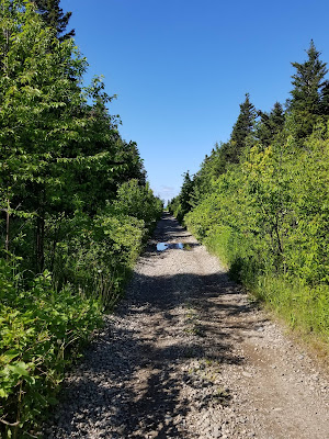
 The first 15 or so kilometres of today's hike on the Trans Canada Trail were along a narrow, shaded, track that ran along the edge of Deer Lake. There were dense shrubs and taller trees on both sides of the trail, but we got occasional glimpses of the lake through gaps created by cleared properties or access tracks. It was sunny and hot, but the also brought delicious cool breezes.

It was an easy and pleasant walk, and at one point we passed a stand of trees that was absolutely full of noisy birds feeding on insects. The highlight was a whole group of noisy, boisterous White-winged Crossbills! There were also Black-capped Chickadees, Pine Grosbeaks, White-throated Sparrows, Yellow Warblers, and Ruby-crowned Kinglets in the mix, all busily feeding and collecting food for their young. It always amazes us when we stumble upon a pocket of so much bird activity, especially when a few meters farther down the trail all will be quiet.


We enjoyed the nice sunny weather and beautiful conditions throughout most of the day. The trail ran beside and along Deer Lake providing us with a gentle cooling breeze on perhaps the hottest day we had endured during our time in Newfoundland.


Throughout the morning the trail wove through a combination of forested, quarried, and residential sections - indicating that the lake region was certainly subject to a great deal of development.


We first ran into a construction sign, which said the trail was closed. We figured this wasn't a big deal, that we could just go around it. However, we found ourselves on the side of a busy road with no sidewalk, and when a motorist swerved at us, and honked their horn right behind us, we decided to look for an alternative route. To those who have not hiked large sections of the Trans Canada Trail, the reality is that there are very few trail markers for the Great Trail, and the ones we've seen are mostly on the trestle bridges. This means that generally you have to navigate by map or App. As it turned out, today was one of those moments when the trail App wasn't working, and Google maps showed the trail down by the water going through residential properties. We decided to head through town to pick up the trail where Google maps suggested it should be. It wasn't. Eventually, after a thorough tour of Pasadena and a visit to the beach, which was full of happy beach goers and people swimming in Deer Lake, we made it out the other side of town. On the way we found a procession of information booths showcasing each province and territory in Canada.


A little past Pasadena we got the Great Trail App back, and saw that the trail apparently went straight down the middle of the Trans Canada Highway. Hoping to see a trail beside the highway that didn't show up on our maps, we looked around at the overpass, but finding no trace of the trail we decided to follow the Boon Siding Rd beside the highway instead. This wide gravel road was an easy, although hot and shade-less walk. We were looking for a place to stop and camp, but there was no water, and the lakefront was completely covered by private property.

When the road ended and we came again to the highway we crossed under it, and were surprised to find an old Trans Canada Trail marker on the beginning of a gravel track. We followed the track for a short distance and came to Rapid Pond, which had a cute little campsite at one end. We decided to stop for the night, as we had covered 32.4 km, and had no idea where the trail went next.


It turned out to be a busy campsite, with a couple coming on an ATV to go swimming in the lake. They were joined by a third guy on a dirt bike. An hour or so later three teenage girls showed up to catch fish. They stayed until it was dark. No one bothered us, and everyone smiled and waved and then mostly just ignored us. Tonight we fall asleep listening to the sounds of the Trans Canada Highway, and watching as the lights of passing cars play across the walls of the tent.


This morning we woke up to the sound of a siren sounding around 7 am. It went off again an hour later. Apparently the whistle was brought over from England in 1920, during construction of the Deer Lake Power and Hydro plant. The station was built to service a pulp and mill in Deer Lake, and the whistle was used to call workers for their shifts, signal lunch time, and mark the end of the day. It is still used today. Having slept in town near the trail, we got up and after enjoying some coffee (but not much else given the rising heat of the day) we trekked onward. The beginning of this morning's hike took us through the city streets of Deer Lake and passed the local hydro electric plant, a sprawling facility which spanned from the top of the hillside down to the lake itself.


It was an easy and pleasant walk, and at one point we passed a stand of trees that was absolutely full of noisy birds feeding on insects. The highlight was a whole group of noisy, boisterous White-winged Crossbills! There were also Black-capped Chickadees, Pine Grosbeaks, White-throated Sparrows, Yellow Warblers, and Ruby-crowned Kinglets in the mix, all busily feeding and collecting food for their young. It always amazes us when we stumble upon a pocket of so much bird activity, especially when a few meters farther down the trail all will be quiet.


We enjoyed the nice sunny weather and beautiful conditions throughout most of the day. The trail ran beside and along Deer Lake providing us with a gentle cooling breeze on perhaps the hottest day we had endured during our time in Newfoundland.


Throughout the morning the trail wove through a combination of forested, quarried, and residential sections - indicating that the lake region was certainly subject to a great deal of development.


By noon we reached the town of Pasadena. It was clear right from the welcome sign at the outskirts that this was a very affluent town. The trail became a paved walkway, and every few hundred meters there was a bench with hanging baskets of flowers beside it. This was very nice, until we lost the trail.


We first ran into a construction sign, which said the trail was closed. We figured this wasn't a big deal, that we could just go around it. However, we found ourselves on the side of a busy road with no sidewalk, and when a motorist swerved at us, and honked their horn right behind us, we decided to look for an alternative route. To those who have not hiked large sections of the Trans Canada Trail, the reality is that there are very few trail markers for the Great Trail, and the ones we've seen are mostly on the trestle bridges. This means that generally you have to navigate by map or App. As it turned out, today was one of those moments when the trail App wasn't working, and Google maps showed the trail down by the water going through residential properties. We decided to head through town to pick up the trail where Google maps suggested it should be. It wasn't. Eventually, after a thorough tour of Pasadena and a visit to the beach, which was full of happy beach goers and people swimming in Deer Lake, we made it out the other side of town. On the way we found a procession of information booths showcasing each province and territory in Canada.


A little past Pasadena we got the Great Trail App back, and saw that the trail apparently went straight down the middle of the Trans Canada Highway. Hoping to see a trail beside the highway that didn't show up on our maps, we looked around at the overpass, but finding no trace of the trail we decided to follow the Boon Siding Rd beside the highway instead. This wide gravel road was an easy, although hot and shade-less walk. We were looking for a place to stop and camp, but there was no water, and the lakefront was completely covered by private property.

When the road ended and we came again to the highway we crossed under it, and were surprised to find an old Trans Canada Trail marker on the beginning of a gravel track. We followed the track for a short distance and came to Rapid Pond, which had a cute little campsite at one end. We decided to stop for the night, as we had covered 32.4 km, and had no idea where the trail went next.


It turned out to be a busy campsite, with a couple coming on an ATV to go swimming in the lake. They were joined by a third guy on a dirt bike. An hour or so later three teenage girls showed up to catch fish. They stayed until it was dark. No one bothered us, and everyone smiled and waved and then mostly just ignored us. Tonight we fall asleep listening to the sounds of the Trans Canada Highway, and watching as the lights of passing cars play across the walls of the tent.


See you on the trail!
Remember to follow our entire adventure here : www.comewalkwithus.online
Comments
Post a Comment